 | ||||||
|
|
|
|
|
||
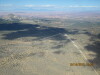
| ||||||
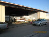
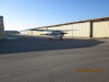
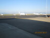
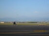
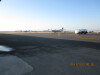
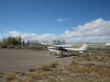
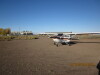
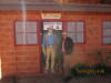
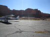
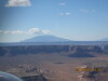
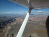
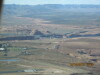
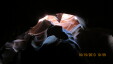
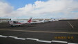
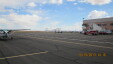
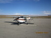
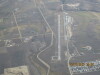
| Preparing Perry's Cessna Hawk XP (210 hp), N7390K, for flight. | Loaded, ready to go, final check, 10/13/13. | The view on the FNL ramp before departure, 10/13/13. | Longs Peak is just visible W of FNL, 10/13/13. | The S end of the ramp at FNL, 10/13/13. | ||
| ||||||
|
|
|

|
|
||
| ||||||
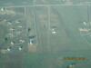
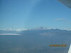
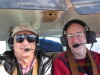
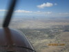
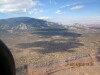
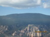
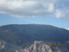
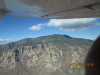
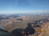
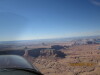
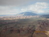
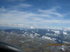
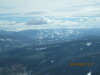
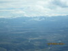
| Looking W, Skywagon Airport (6CO6) on the left, Lazy W Airport (86CO) on the right, 10/13/13. | Longs Peak comes into view when we get close to the top of the haze layer at 8,500 MSL, 10/13/13. | Looking S to Pikes Peak, above the haze layer, 10/13/13. | Perry, enjoying the view, while piloting over South Park, CO, 10/13/13. | Perry and Jer/ enjoying the view, while piloting over South Park, CO, 10/13/13. | ||
| ||||||
|
|
|
|
|
||
| ||||||
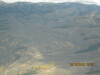
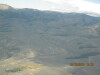
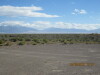
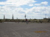
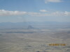
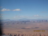
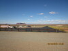
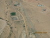
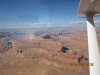
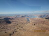
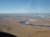
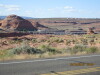
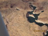
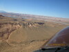
| Looking NE to Granite Mountain Lodge Airstrip (CO11), RWY 36, S of Salida, at the N end of the San Luis Valley, CO, 1, 10/13/13. | Looking NE to Granite Mountain Lodge Airstrip (CO11), RWY 36, S of Salida, at the N end of the San Luis Valley, CO, 2, 10/13/13. | Looking ESE to Great Sand Dunes, Colorado from Sand Dunes Hot Springs Airport (Private, no airport designator, prior permission only), Hooper, CO, 10/13/13. | N7390K tied down for the night, Sand Dunes Hot Springs Pool is just across the road, under the wind sock, 10/13/13. | Perry taking a picture of what he just landed on, 10/13/13. | ||
| ||||||
|
|
|
|

|
||
| ||||||
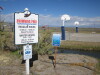
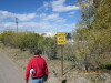
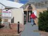
| Sand Dunes Hot Springs Pool welcoming signs, 10/13/13. | The walk up the entrance driveway, to the pool, 10/13/13. | The Mile Deep Grille serves lunch and dinner at the pool, 10/13/13. | Entrance to the pool, 10/13/13. | Entrance window... pay your entrance fee here, 10/13/13. | ||
| ||||||
|
|
|
|
|
||
| ||||||
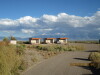
| The cabins... we had cabin #1 on the left, 10/13/13. | Looking NW from the cabins to the camping area, RV parking to the left, 10/13/13. | Looking NE from the cabin to see that N7390K is ok, 10/13/13. | Preparing N7390K for flight, to depart Sand Dunes Pool for Gouldings Lodge, UT and Page, AZ, 10/14/13. | Looking W toward Shiprock. We are going to fly S of Shiprock, so this is not the traditional view that looks like a sailing ship, 10/14/13. | ||
| ||||||
|
|
|
|
|
||
| ||||||
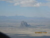
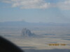
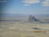
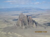
| Shiprock, 1, 10/14/13. | Shiprock, 2, 10/14/13. | Shiprock, 3, 10/14/13. | Shiprock, 4, 10/14/13. | Shiprock, 5, 10/14/13. | ||
| ||||||
|
|
|
|
|
||
| ||||||
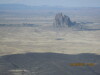
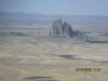
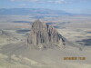
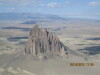
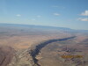
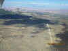
| Shiprock, 6, 10/14/13. | Shiprock, 7, 10/14/13. | Shiprock, 8, 10/14/13. | Shiprock, 9, 10/14/13. | Comb Ridge, AZ, looking SW, 10/14/13. | ||
| ||||||
|
|
|
|
|
||
| ||||||
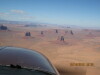
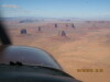
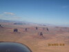
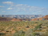
| Monument Valley, 1, 10/14/13. | Monument Valley, 2, 10/14/13. | Monument Valley, 3, 10/14/13. | Monument Valley, 4, 10/14/13. | Gouldings Lodge, looking NE to the Monument Valley Airport (UT25, private, prior permission only), 10/14/13. | ||
| ||||||
|
|
|
|
|
||
| ||||||
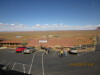
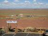
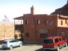
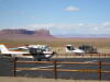
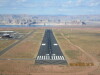
| N7390K is the second airplane from the right, 10/14/13. | Looking E from the restaurant (good food!) to the old Gouldings Trading Post and Museum, 10/14/13. | John Wayne shot many movies here, 10/14/13. | Looking S from Monument Valley Airport to Gouldings Lodge, 10/14/13. | Looking N to the Monument Valley Airport RWY 34, 10/14/13. | ||
| ||||||
|
|
|
|
|
||
| ||||||
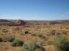
| N7390K on the ramp at Monument Valley Airport. Perry is preflighting, 10/14/13. | Navajo Mountain, looking W, just S of Lake Powell, 10/14/13. | Small, private airstrip ~5nm W of Monument Valley Airport, 10/14/13. | Navajo Mountain Airport, center of screen L/R, looking NW, 10/14/13. | Navajo Mountain Airport, looking N, 10/14/13. | ||
| ||||||
|
|
|
|
|
||
| ||||||
| Navajo Mountain Airport, looking NNE, 10/14/13. | Radio antennas on top of Navajo Mountain, 1, 10/14/13. | Radio antennas on top of Navajo Mountain, 2, 10/14/13. | Navajo Mountain, looking N, 10/14/13. | Canyons west of Rainbow Bridge and south side of Lake Powell, 10/14/13. | ||
| ||||||
|
|
|
|
|
||
| ||||||
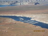
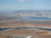
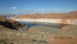
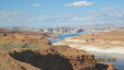
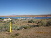
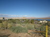
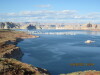
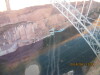
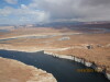
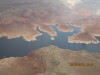
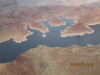
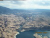
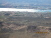
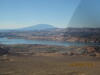
| Lake Powell, looking NW, approaching Page, 1, 10/14/13. | Lake Powell, looking NW, approaching Page, 2, 10/14/13. | Lake Powell, looking NW, approaching Page, 3, 10/14/13. | Antelope Island, Navajo electric generating station on L, 10/14/13. | Antelope Marina, looking NW, 10/14/13. | ||
| ||||||
|
|
|
|
|
||
| ||||||
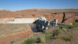
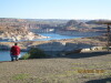
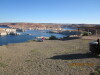
| Antelope Marina, looking NNW, 10/14/13. | Wahweap Marina, looking W, 10/14/13. | Glen Canyon Dam, looking NW, 10/14/13. | Page Airport (KPAG), AZ, final approach RWY 33, 10/14/13. | Wahweap Marina is the dots and the trees on the bluff, 10/14/13. | ||
| ||||||
|
|
|
|
|
||
| ||||||
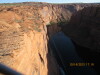
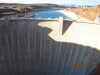
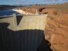
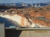
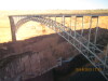
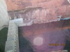
| The bridge at Glen Canyon Dam, note the power lines, 10/14/13. | The bridge at Glen Canyon Dam, looking E, 10/14/13. | Glen Canyon Dam, 10/14/13. | Safety barricade on the water, Wahweap Marina on left, 10/14/13. | Wahweap Marina, 1, 10/14/13. | ||
| ||||||
|
|
|
|
|
||
| ||||||
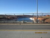
| Wahweap Marina, 2, 10/14/13. | Wahweap Marina, 3, 10/14/13. | Wahweap Marina, 4, 10/14/13. | Perry and other tourists taking pictures of Lake Powell and Wahweap Marina, 10/14/13. | Perry contemplating a picture of the dam, looking S, 10/14/13. | ||
| ||||||
|
|
|
|
|
||
| ||||||
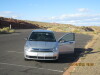
| Perry taking the picture, 10/14/13. | Our conveyance. AVIS rents at the Page Airport, 10/14/13. | On the bridge, looking down at the tour rafts, 10/14/13. | Colorado River below the dam, 10/14/13. | Colorado River above the dam, 10/14/13. | ||
| ||||||
|
|
|
|
|
||
| ||||||
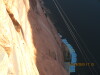
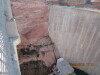
| Generator house, 1, 10/14/13. | Generator house, 2, 10/14/13. | Glen Canyon Dam, looking N, up the Colorado River, 10/14/13. | Note metal walkway out of the dam, across the rocks, 10/14/13. | Openings in the dam on the east side, 10/14/13. | ||
| ||||||
|
|
|
|
|
||
| ||||||
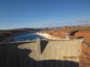
| Note the high water mark behind the dam, 10/14/13. | Wahweap Marina, across the mesa, 10/14/13. | River runner boat description, 10/14/13. | River runner boat, Marble, 10/14/13. | The bridge, looking SE from the visitor center, 10/14/13. | ||
| ||||||
|
|
|
|
|
||
| ||||||
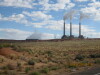
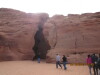
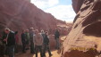
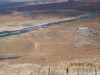
| Gravel bar (island) below the dam, 10/14/13. | Tour rafts below the dam, 10/14/13. | Antelope Canyon Tours, the indians run the Slot Canyon tour, 10/15/13. | Navajo Power Plant, looking N, 10/15/13. | Antelope Canyon Slot Canyon W entrance. The tour starts here. The slot canyon tour is about 1/4 mile of walking, 10/15/13. | ||
| ||||||
|
|
|
|
|
||
| ||||||
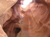
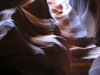
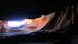
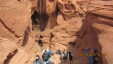
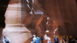
| Slot Canyon, looking up, 10/15/13. | Slot Canyon, looking in, 10/15/13. | Slot Canyon, several turns in, 10/15/13. | Slot Canyon, looking up at the beak, 1, 10/15/13. | Slot Canyon, looking up at the beak, 2, 10/15/13. | ||
| ||||||
|

|
|
|
|
||
| ||||||
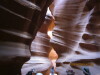
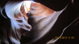
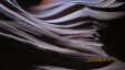
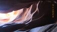
| Amazing swirls, 10/15/13. | Log stuck at recent high water mark, ~15 feet above us, 10/15/13. | Note texture on the walls, 10/15/13. | Looking up from the dark to the light, 1, 10/15/13. | Looking up from the dark to the light, 2, 10/15/13. | ||
| ||||||
|
|
|
|
|
||
| ||||||
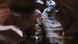
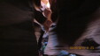
| Getting brighter lower, almost out, 10/15/13. | Slot Canyon, E end, where the water comes in. This was about a 1/4 mile walk thru the canyon, on loose, fine sand, 10/15/13. | Looking into the Slot Canyon, where the water goes in, 10/15/13. | Almost out the lower end of the slot canyon, on the way out, 10/15/13. | Antelope Marina has a restaurant down at the water, 10/15/13. | ||
| ||||||
|
|
|
|
|
||
| ||||||
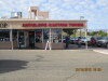
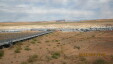
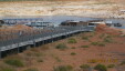
| Antelope Marina walkway is really an elevated golf cart road, 10/15/13. | Page Airport (KPAG), AZ, "Cessna 207 Heaven", 10/15/13. | Page Airport (KPAG), looking from our tiedown to the terminal building, and the Navajo Generating Station stacks, 10/15/13. | Antelope Marina, looking NE, 1, 10/15/13. | Antelope Marina, looking NE, 2, 10/15/13. | ||
| ||||||
|
|
|
|
|
||
| ||||||
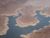
| Navajo Mountain, looking E, 10/15/13. | Bays on Lake Powell, as we proceed E, 1, 10/15/13. | Bays on Lake Powell, as we proceed E, 1, 10/15/13. | Dangling Rope Marina, 10/15/13. | Canyon leading to Rainbow Bridge, 10/15/13. | ||
| ||||||
|
|
|
|
|
||
| ||||||
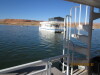
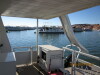
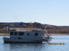
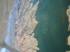
| Reflection Canyon. We beached the WildWind II in the side canyon on the rocks upstream of the "thumb" at the top edge of the picture on the July 2013 trip, 10/15/13. | Reflection Canyon. We beached the WildWind II in the mostly hidden cove at the left quarter of the picture on the July 20 13 trip, 10/15/13. | Bullfrog entrance road, looking SW, 10/15/13. | N7390K tied down at Bullfrog Airport (U09), AZ, 10/15/13. | Looking from WildWind to the Pegasus, 10/16/13. | ||
| ||||||
|
|
|
|
|
||
| ||||||
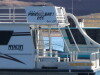
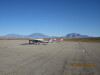
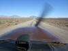
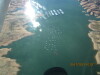
| Looking S down the buoy field from WildWind, 10/16/13. | The U.S.S Ark, a neighbor of the WildWind, 10/16/13. | Cool logo... Vail, CO "It is a Powder Day" updated to "It is a Powell Day", 10/16/13. | There were two Cessna Hawk XPs at Bullfrog, 10/17/13. | Takeoff Bullfrog RWY 1, 4167 MSL, 3500 feet long, 10/17/13. | ||
| ||||||
|
|
|
|
|
||
| ||||||
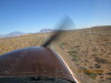
| Airborne, 10/17/13. | Turning for the buoy field, 1, 10/17/13. | Turning for the buoy field, 2, 10/17/13. | Bullfrog buoy field, 1, 10/17/13. | Bullfrog buoy field, 2, 10/17/13. | ||
| ||||||
|
|
|
|
|
||
| ||||||
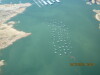
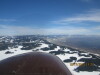
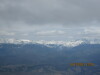
| Bullfrog buoy field, 3, rotate 10/17/13. | Bullfrog buoy field, 4, 10/17/13. | Bullfrog buoy field, 5, find the WildWind II, 10/17/13. | Over Grand Mesa, flying NE, 10/17/13. | Mount Sopris, S of Carbondale, CO, looking E, 10/17/13. | ||
| ||||||
|
|
|
|

|
||
| ||||||
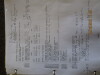
| Vail Ski Area, CO, 10/17/13. | Looking E to Sawtooth Mountain, at the top of Buchanan Pass. We are on the W side of the Continental Divide, over the Colorado River, 10/17/13. | Winter Park Ski Area, looking S, 10/17/13. | Granby/Grand County Airport (KGNB), CO, looking E, 10/17/13. | Picture of log sheet, 10/16/13. | ||
| ||
|
||
| ||
| Picture of tach sheet, 10/16/13. | ||