 | ||||||
|
|
|
|
|
||
| ||||||
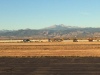
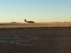
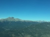
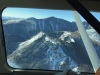
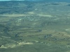
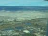
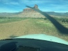
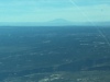
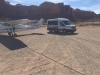
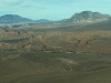
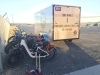
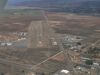
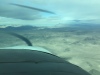
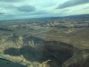
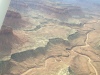
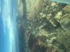
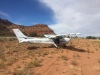
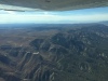
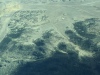
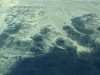
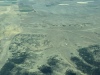
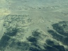
| At KFNL, looking W to Longs Peak, 14,259 MSL, 10/22/21 | Blue Angels C130 still at KFNL after the airshow, 10/22/21 | Carter Lake west shore, looking N, do not see the NOTAMed blasting area, 10/22/21 | Longs Peak, looking W, 1, 10/22/21 | Longs Peak, looking W, 2, 10/22/21 | ||
| ||||||
|
|
|
|
|
||
| ||||||
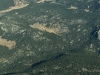
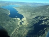
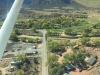
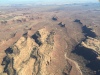
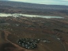
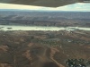
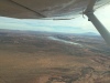
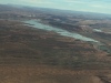
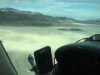
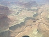
| Elk Park Ranch (34CD), looking NW, note hangar at west end 10/22/21 | Continental Divide, Buchanan Pass, Sawtooth Mountain to the left, looking WSW, 1, 10/22/21 | Continental Divide, Buchanan Pass, Sawtooth Mountain to the left, looking WSW, 1, 10/22/21 | Looking S over Sawtooth Mountain at Buchanan Pass, 10/22/21 | Across Buchanan Pass, looking W at Lake Granby, Arapahoe Bay campground in the foreground, 10/22/21 | ||
| ||||||
|
|
|
|
|
||
| ||||||
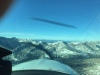
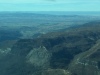
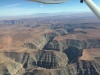
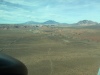
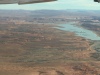
| Granby Airport (KGNB), CO, looking W at RWY-27, 10/22/21 | Looking WNW over Hot Sulphur Springs, CO, 10/22/21 | Looking W to Kremmling Airport (20V), CO, RWY-27, 10/22/21 | Eagle Airport (KEGE), CO, RWY-25 under the strut, 10/22/21 | Cottonwood Pass, looking SW toward Aspen and the Maroon Bells, 1, 10/22/21 | ||
| ||||||
|
|
|
|
|
||
| ||||||
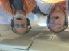
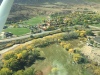
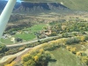
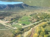
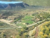
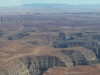
| Cottonwood Pass, looking SW toward Aspen and the Maroon Bells, 2, 10/22/21 | Jer/ Eberhard (L) and Rick Turley (R) enjoying mountain flying, 10/22/21 | North Fork Valley Airport (7V2), Paonia, CO, RWY-25 is on the mesa beyond town, looking SSW, 10/22/21 | Fueling at 7V2, airport terminal and courtesy car in the background, 10/22/21 | North Fork Valley Airport (7V2) on RWY-23, looking WNW to ramp. Call the Airport Manager for courtesy car access, 10/22/21 | ||
| ||||||
|
|
|
|
|
||
| ||||||
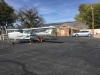
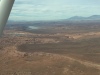
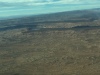
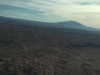
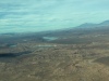
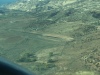
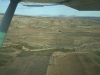
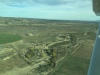
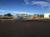
| Delta Airport (KAJZ), CO, 10/22/21 | Dolores Point Airport, Land RWY-14, Takeoff RWY-32, 10/22/21 | Dolores Point, looking NW at RWY-32, 10/22/21 | Dolores Point sign requesting vehicles to keep off runway, 10/22/21 | Looking NNW for takeoff RWY-32, Dolores Point, CO, 10/22/21 | ||
| ||||||
|
|
|
|
|
||
| ||||||
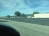
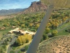
| Access roads at Dolores Point Airport, 10/22/21 | Hubbard Airport (9CO3), Gateway, CO, looking NE to Gateway, CO, 10/22/21 | Hubbard Airport (9CO3), Gateway, CO, Land RWY-18, Takeoff RWY-36, 10/22/21 | Departing Hubbard, Northbound, RWY-36, 10/22/21 | Off Hubbard, circling Gateway Canyons Resort & Spa, CO, 1, 10/22/21 | ||
| ||||||
|
|
|
|
|
||
| ||||||
| Off Hubbard, circling Gateway Canyons Resort & Spa, CO, 2, 10/22/21 | Off Hubbard, circling Gateway Canyons Resort & Spa, CO, 3, 10/22/21 | Looking W across Gateway, Hubbard RWY-18/36 at top, 1, 10/22/21 | Looking W across Gateway, Hubbard RWY-18/36 at top, 2, 10/22/21 | Looking W across Gateway, Hubbard RWY-18/36 at top, 3, 10/22/21 | ||
| ||||||
|
|
|
|
|
||
| ||||||
| Looking W across Gateway, Hubbard RWY-18/36 at top, 4, 10/22/21 | Navajo Mountain in the haze, 10/22/21 | Monument Valley rock outcroppings, 10/22/21 | Goosenecks on the San Juan River, 10/22/21 | Looking SE at Goosenecks, enroute Gouldings Lodge at Monument Valley, 10/22/21 | ||
| ||||||
|
|

|

|

|
||
| ||||||
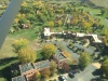
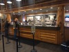
| Gouldings Lodge at Monument Valley beyond the tail, for lunch, 10/22/21 | Picture thru the bus window, looking S, Arts and gift shop at Gouldings Lodge, 10/22/21 | Office, Gouldings Museum and movie house at Gouldings Lodge 10/22/21 | Up the stairs for lunch at The Stagecoach Dining Room, 10/22/21 | Looking N to the airport: Gouldings Lodge at Monument Valley, 10/22/21 | ||
| ||||||
|
|
|
|
Open movie img-3611.mov | ||
| ||||||
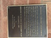
| Monuments in the distance, 10/22/21 | Still under the mask. Do we have to have the hat? Note: the road and monument is a reflection in the door. 10/22/21 | Gouldings Monument Valley Museum plaque, 10/22/21 | Looking SSW to Gouldings Lodge and services in the shadow, 10/22/21 | 360 degree view from the Monument Valley Airport (UT25), 10/22/21 | ||
| ||||||
|
|
|
|
|
||
| ||||||
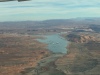
| Preflighting N8768M before taking off on RWY-34, 10/22/21 | Lake Powell and Bullfrog Basin, looking N, 1, 10/22/21 | Lake Powell and Bullfrog Basin, looking N, 2, 10/22/21 | Enroute to Nokai Dome Airport, 10/22/21 | Navajo Mountain, looking WSW, 10/22/21 | ||
| ||||||
|
|
|
|
|
||
| ||||||
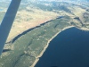
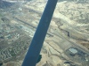
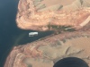
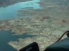
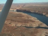
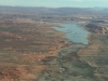
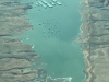
| Looking N toward Bullfrog Bay, Lake Powell, 10/22/21 | Looking ENE toward Lake Powell, Painted Wall. Moki Canyon entrance to the right, 10/22/21 | Halls Crossing, boat slips, looking N to Bullfrog Bay, 10/22/21 | Halls Crossing Ferry ramp, old Halls Crossing Airport in the foreground, 10/22/21 | Charles Hall Ferry at Halls Crossing, UT, 10/22/21 | ||
| ||||||
|
|
|
|
|
||
| ||||||
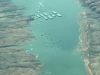
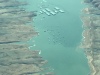
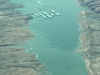
| Bullfrog houseboat buoy field, looking N, 10/22/21 | Lake Powell Painted Wall and Moki Canyon entrance, looking SE, 10/22/21 | Bullfrog Basin school and infrastructure, 10/22/21 | Bullfrog Basin housing, buoy field and covered slips, 1, 10/22/21 | Bullfrog Basin housing, buoy field and covered slips, 2, 10/22/21 | ||
| ||||||
|
|
|
|
|
||
| ||||||
| Bullfrog Basin housing, buoy field and covered slips, 3, 10/22/21 | Bullfrog Basin Airport (U07), UT ramp, looking E. Verizon cell phone works here, AT&T cell does not. 10/22/21 | Departing Bullfrog Basin Airport RWY-1, looking N to Offshore Marina, further to Ticaboo Lodge, 10/22/21 | Lake Powell, Offshore Marine, N of Bullfrog Basin, 10/22/21 | Bullfrog Bay, looking SSW toward Navaho Mountain, 10/22/21 | ||
| ||||||
|
|
|
|
|
||
| ||||||
| Bullfrog Bay, looking S, 1, 10/22/21 | Bullfrog Bay, looking S, 2, 10/22/21 | Bullfrog Bay, looking S, 3, 10/22/21 | Bullfrog Bay, looking S, 4, 10/22/21 | Escalante Muni Airport (1L7), UT, looking WNW to RWY-31, 10/22/21 | ||
| ||||||
|
|
|
|
|
||
| ||||||
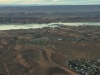
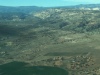
| Escalante UT, looking NW, 10/22/21 | Escalante Muni Airport (1L7), UT, looking NW to RWY-31, 10/22/21, 10/22/21 | Escalante Muni Airport looking E, Henry Mountains in background, 10/22/21, 10/22/21 | Escalante Muni Airport, right base, landing RWY-13, 10/22/21 | Rick Turley with N8768M at Escalante Muni Airport (1L7), UT, 10/22/21 | ||
| ||||||
|
|
|
|
|
||
| ||||||
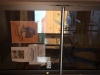
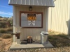
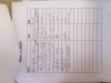
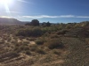
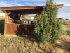
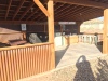
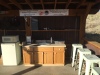
| Escalante Muni Airport sign-in roster and local information board, 10/22/21 | Escalante Muni Airport sign-in sheet, note Brad Reak from KFNL at the top, 10/22/21 | Escalante airport pilot lounge with access to kitchen, restroom and shower, 10/22/21 | Escalante airport pilot lounge and courtesy car, 10/22/21 | Escalante RAF shelter center, steps to airport pilot lounge, 10/22/21 | ||
| ||||||
|
|
|
|
|
||
| ||||||
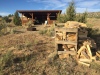
| Escalante RAF shelter, looking E, 1, 10/22/21 | Escalante RAF shelter, 2, 10/22/21 | Escalante RAF shelter, note wood pile, 4, 10/22/21 | Escalante RAF shelter, note wood pile, 5, 10/22/21 | Escalante airport, departing RWY-13, 10/22/21 | ||
| ||||||
|
|
|
|
|
||
| ||||||
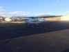
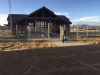
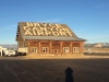
| Bryce Canyon Airport (KBCE), UT, looking SE toward interesting rock formations, 10/22/21 | Bryce Canyon Airport (KBCE), UT, wind sock, looking SE, 10/22/21 | N8768M tied down at Bryce Canyon, 10/22/21 | Rick at the Bryce Canyon Airport terminal building, 10/22/21 | Bryce Canyon Airport log hangar, sadly in disrepair, 1, 10/22/21 | ||
| ||||||
|
|
|
|
|
||
| ||||||
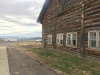
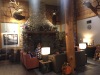
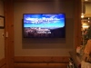
| Bryce Canyon Airport log hangar, sadly in disrepair, 2, 10/22/21 | Ebike Rentals at Bryce Canyon Airport, 10/22/21 | Rick at Bryce Canyon, UT, Ruby's Inn checkin, 10/22/21 | Fireplace in Ruby's Inn lobby, 10/22/21 | Video introduction to Ruby's Inn, and Bryce Canyon Adventures, 10/22/21 | ||
| ||||||
|
|
|
|
|
||
| ||||||
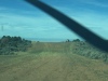
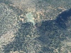
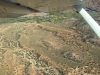
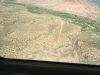
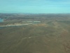
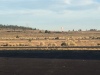
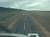
| Parowan Airport (1L7), UT, looking down RWY-4, 10/23/21 | Right downwind Parowan RWY-22, 10/23/21 | Short final Parowan RWY-22, 10/23/21 | We are going to land on the next dry lakebed west (left corner of pic), 10/23/21 | We are going "shop" the IBEX dry lakebed beyond the one below us. 10/23/21 | ||
| ||||||
|
|
|
|
|
||
| ||||||
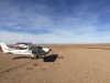
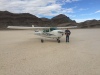
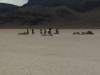
| After "shopping" IBEX dry lakebed, we will use this island for LVR="Last Visual Reference" for vertical guidance, 10/23/21 | We see some campers on the west shore of IBEX dry lakebed, 10/23/21 | We are on left downwind, for landing S on the other side of the island, just beyond it. 10/23/21 | Rick with N8768M on the dry lakebed, 10/23/21 | Dads and kids, visitors after we landed, 10/23/21 | ||
| ||||||
|
|
|
|
|
||
| ||||||
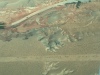
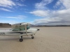
| N8768M on the dry lakebed, looking NW, 10/23/21 | Hanksville Airport (KHVE), UT, Rick at lunch, 10/23/21 | Angel Point Airport (US-1486), UT, RWY11/29, looking SE, 10/23/21 | We found an operating ELT at Angel Point and reported it to FSS, 1, 10/23/21 | Airplane wreck at Angel Point, 2, 10/23/21 | ||
| ||||||
|
|
|
|
|
||
| ||||||
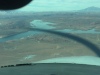
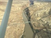
| Airplane wreck at Angel Point, 3, 10/23/21 | Happy Canyon Airport, UT, 1, 10/23/21 | Happy Canyon Airport, UT, 2, 10/23/21 | Lake Powell UT-95 bridge at Hite, looking NE, 1, 10/23/21 | Lake Powell UT-95 bridge at Hite, looking NE, 2, 10/23/21 | ||
| ||||||
|
|
|
|
|
||
| ||||||
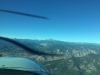
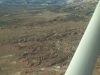
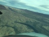
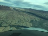
| Lake Powell UT-95 bridge at Hite, looking E, 3, 10/23/21 | Hite Airport (UT03), UT, centerline, center, left, 1, 10/23/21 | Hite Airport, (UT03), UT centerline, center, left, 2, 10/23/21 | Hite Airport, (UT03), UT centerline, center, far left, looking NW 3, 10/23/21 | Rough terrain enroute westbound back to Bryce Canyon, 10/23/21 | ||
| ||||||
|
|
|
|
|
||
| ||||||
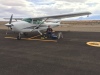
| Bryce Canyon Airport (KBCE), parked on the main ramp, 1, 10/24/21 | Bryce Canyon Airport (KBCE), parked on the main ramp, 2, 10/24/21 | Bullfrog Basin houseboat buoy field, looking S, 1, 10/24/21 | Bullfrog Basin houseboat buoy field, looking S, 2, 10/24/21 | Bullfrog Basin houseboat buoy field, looking S, 3, 10/24/21 | ||
| ||||||
|
|
|
|
|
||
| ||||||
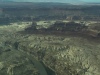
| Bullfrog Basin houseboat buoy field, looking S, 4, 10/24/21 | Fry Canyon Airport (UT74), UT, stuck in the soft dirt, 1, 10/24/21 | Fry Canyon Airport (UT74), UT, stuck in the soft dirt, 2, 10/24/21 | Cortez Airport (KCEZ), CO, flyby, looking down RWY-21, 1, 10/24/21 | Cortez Airport (KCEZ), CO, flyby, looking down RWY-21, 2, 10/24/21 | ||
| ||||||
|
|
|
|
|
||
| ||||||
| Cortez Airport (KCEZ) flyby, looking down RWY-21, 3, 10/24/21 | Amazing road on top of the mesa, 10/24/21 | Durango Airport (KDRO), CO, looking SE, 1, 10/24/21 | Durango Airport (KDRO), CO, looking SE, 2, 10/24/21 | Lux Field Airport (25CD), CO, in South Park, 1, 10/24/21 | ||
| |||||
|
|
|
|
||
| |||||
| Lux Field Airport (25CD), CO, in South Park, 2, 10/24/21 | Lux Field Airport (25CD), CO, in South Park, 3, 10/24/21 | Lux Field Airport (25CD), CO, in South Park, 4, 10/24/21 | Lux Field Airport (25CD), CO, in South Park, 5, 10/24/21 | ||