 | ||||||
|
|
|
|
|
||
| ||||||
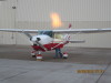
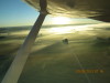
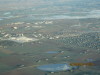
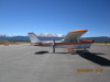
| Jeff preflighting N8892T, Cessna 182 at Greeley-Weld County Airport (GXY), preparing for mountain flying, 09/28/13 | Ground fog, looking E from GXY, 09/28/13 | Ground fog over the Poudre River, looking W from GXY, 09/28/13 | Rocky Mountains, W of Loveland, 09/28/13 | Walmart Distribution Center, ground fog, looking NW over Fort Collins-Loveland Airport (KFNL), 09/28/13 | ||
| ||||||
|
|
|
|
|
||
| ||||||
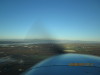
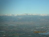
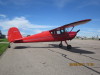
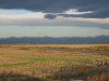
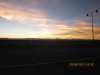
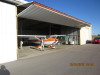
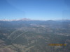
| Longs Peak, looking W from Loveland, 09/28/13 | Redbird, N89297, Cessna 140 on the ramp at Greeley-Weld County Airport (GXY), 09/29/13 | Sunrise on the mountains W of Front Range Airport (FTG), 09/30/13 | Sunrise on the mountains NW of Front Range Airport (FTG), Longs Peak on the right, 09/30/13 | Denvers Imaginary Airport (DIA), looking N, 09/30/13 | ||
| ||||||

|

|
|
|
|
||
| ||||||
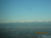
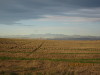
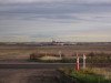
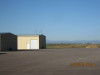
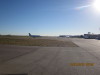
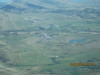
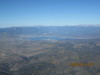
| Sawtooth Mountain, looking W | Sawtooth Mountain (left 1/4), Longs Peak on the right, 09/30/13. | Corona Pass (W of Boulder) is the flat bench on the left, to Longs Peak on the right, looking W from Front Range Airport (FTG), 09/30/13. | Colorado Rocky Mountains, looking W from Greeley-Weld County Airport (GXY), 10/01/13. | Jet visiting the ramp at Greeley-Weld County Airport (GXY), 10/01/13. | ||
| ||||||
|
|
|
|
|
||
| ||||||
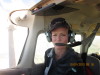
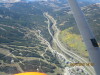
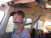
| Paula preflighting N21764, Cessna 172 for mountain flying, 10/01/13. | Paula checking the terrain, 10/01/13. | James Peak, flat bench is Corona Pass, 10/01/13. | Longs Peak to Twin Sisters, looking NW, 10/01/13. | Cement Plant W of Lyons, looking N, note flood plain, 10/01/13. | ||
| ||||||
|
|

|
|
|
||
| ||||||
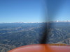
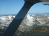
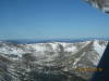
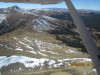
| Corona Pass, looking W, 1, 10/01/13. | Corona Pass, looking W, 2, 10/01/13. | Paula after Fueling at Glenwood Springs Airport (GWS), 10/01/13. | Paula at Leadville, with N21764 Cessna 172, looking W to Mount Massive, 10/01/13. | Top of Copper Mountain Ski Area, looking NW, note ski lifts, 10/01/13. | ||
| |||||
|
|
|
|
||
| |||||
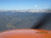
| Copper MOutnain Ski Area, looking N toward Vail Pass on I-70, 10/01/13. | Paula grooving with Mountain Flying, 10/01/13. | Lake Granby, looking WNW, Arapahoe Bay on the right, 10/01/13. | Sawtooth Mountain, at Buchanan Pass, looking NE from Tabernash, 10/01/13. | ||