 | ||||||
|
|
|
|
|
||
| ||||||
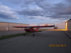
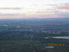
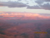
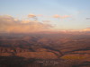
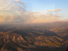
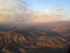
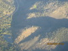
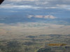
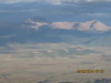
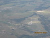
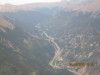
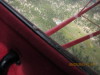
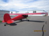
| N89297, Cessna 140, ready to go, just barely dawn, 09/22/13. | Pikes Peak near Colorado Springs, from pattern altitude at Fort Collins-Loveland Airport (FNL), 09/22/13. | Longs Peak at dawn, with clouds, 09/22/13. | Looking W from Boulder to the Continental Divide, 09/22/13. | Boulder looking W up Boulder Canyon to the Continental Divide, 1, 09/22/13. | ||
| ||||||
|
|
|

|
|
||
| ||||||
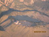
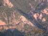
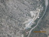
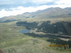
| Boulder looking W up Boulder Canyon to the Continental Divide, 2, 09/22/13. | NCAR, National Center for Atmospheric Research, 09/22/13. | Union Pacific Railroad, track washout just uphill from "Tunnel 2", 09/22/13. | Athanasiou Valley Airport (CO07), near Blackhawk, looking SW, 1, 09/22/13. | Athanasiou Valley Airport (CO07), near Blackhawk, looking SW, 2, 09/22/13. | ||
| ||||||
|
|
|
|
|
||
| ||||||
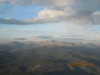
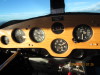
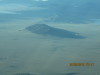
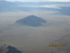
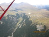
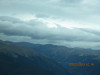
| Mount Evans looking SW, 09/22/13. | Kenosha Pass looking SW, 09/22/13. | N89297 over Kenosha Pass, 12,500 MSL, 09/22/13. | Santa Maria Jesus statue, 1, 09/22/13. | Santa Maria Jesus statue, 2, 09/22/13. | ||
| ||||||

|
|
|
|
|
||
| ||||||
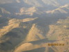
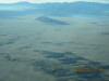
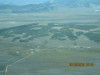
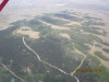
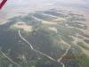
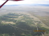
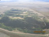
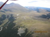
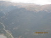
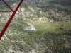
| Over the ridge SE of Kenosha Pass, looking SW into South Park, Colorado, 09/22/13. | Michigan Hill, 1, 09/22/13. | Michigan Hill, 2, 09/22/13. | Balloons looking SE toward 11 Mile reservoir, 09/22/13. | Balloons looking SE toward 11 Mile reservoir, 09/22/13. | ||
| ||||||
|
|
|
|
|
||
| ||||||
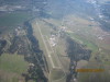
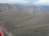
| Balloons looking SE toward 11 Mile reservoir, 09/22/13. | Harriet Alexander Field Airport (ANK) Salida, Colorado, USA, looking SW toward RWY24, 1, 09/22/13. | Harriet Alexander Field Airport (ANK) Salida, Colorado, USA, looking SW toward RWY24, 2, 09/22/13. | Harriet Alexander Field Airport (ANK) Salida, Colorado, USA, looking E toward RWY6, 09/22/13. | Mt Princeton Hot Springs, looking NE, note new pool on the right, 09/22/13. | ||
| ||||||
|
|
|
|
|
||
| ||||||
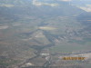
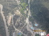
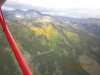
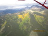
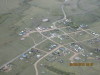
| Cottonwood Hot Springs Inn & Spa - Buena Vista, Colorado., 09/22/13. | Aspens are beginning to turn colors, NW of Buena Vista, Colorado, 1, 09/22/13. | Aspens are beginning to turn colors, NW of Buena Vista, Colorado, 2, 09/22/13. | Como, Colorado, looking SE, note part of old railroad roundhouse near the top of this picture, 09/22/13. | Michigan Hill, looking NE, 09/22/13. | ||
| ||||||
|
|
|
|
|
||
| ||||||
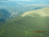
| Michigan Hill, looking SE, 09/22/13. | Michigan Hill, looking SE, Cathie's cabin circled, 09/22/13. | Michigan Hill, looking S, 1, 09/22/13. | Michigan Hill, looking S, 2, 09/22/13. | Top of Guanella Pass, looking NE, 09/22/13. | ||
| ||||||
|
|
|
|
|
||
| ||||||
| Parking lot at top of Guanella Pass, looking SE, 1, 09/22/13. | Parking lot at top of Guanella Pass, looking SE, 2, 09/22/13. | Berthoud Pass AWOS, located at 12,493 feet MSL, 1 mile east of the Berthoud Pass summit, at the summit of Mines Peak. 09/22/13. | Empire, Colorado, looking NW toward Berthoud Pass, 09/22/13. | Berthoud Pass AWOS, located at 12,493 feet MSL, 1 mile E of the Berthoud Pass summit, at the summit of Mines Peak. 09/22/13. | ||
| ||||||
|
|
|
|
|
||
| ||||||
| Berthoud Pass AWOS, located at 12,493 feet MSL, 1 mile E of the Berthoud Pass summit, at the summit of Mines Peak. 09/22/13. | Corona Pass, looking NW, Rawlings Pass on the right, 09/22/13. | Elk Park Airport (34CD) looking NNE, note: all OK, hangar door is open, 09/22/13. | Elk Park Airport (34CD) looking N, runway is usable and dry, 09/22/13. | N89297, Cessna 140, returned from adventure, ready to put back in the hangar, 09/22/13. | ||