 | ||||||
|
|
|
|

|
||
| ||||||
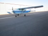
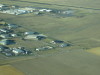
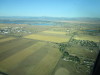
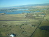
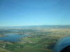
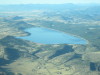
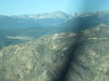
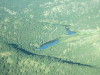
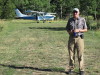
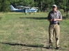
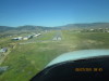
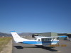
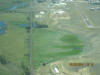
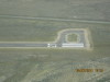
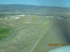
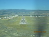
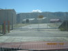
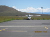
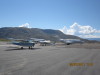
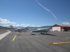
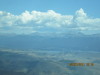
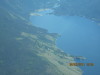
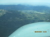
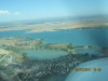
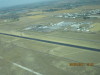
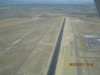
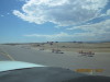
| N9513G preflighted, ready to go, 08/27/2011 | FNL RWY 24, during RWY 15/33 rebuild 08/15/11-09/01/11 08/27/2011 | Departed FNL. Looking WSW across RWY 24 and Boyd Lake towards Longs Peak, 08/27/2011 | FNL RWY 15/33 1, during runway rebuild 08/15/11-09/01/11, 08/27/2011 | FNL RWY 15/33 2, during runway rebuild 08/15/11-09/01/11, 08/27/2011 | ||
| ||||||

|
|
|
|
|
||
| ||||||
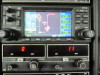
| FNL RWY 15/33 3, during runway rebuild 08/15/11-09/01/11, 08/27/2011 | A clear, calm morning, headed for Elk Park Airport 34CD, SE of Longs Peak, 08/27/2011 | Garmin GNS-430 WAAS flight plan FNL->ELKPK, 08/27/2011 | The siphon at the Dam Store, US-34, Thompson Canyon, Loveland, Colorado, 08/27/2011 | The break in the ditch (left center) is where the water goes down thru the siphon at the Dam Store, 08/27/2011 | ||
| ||||||
|
|
|
|
|
||
| ||||||
| The Dam Store, Colorado-Big Thompson Project siphon in the background, 08/27/2011 See: http://www.usbr.gov/projects/Project.jsp?proj_Name=Colorado-Big+Thompson+Project |
Big Thompson siphon from the ground on US-34 westbound at the Dam Store, 08/27/2011 | Carter Lake feeds N thru the siphon at the Dam Store to Horsetooth Reservoir, 08/27/2011 | Longs Peak with Twin Sisters in the foreground, 08/27/2011 | Pressure line feeding Flatiron Reservoir electric generating station, which then pumps water up to Carter Lake, 08/27/2011 | ||
| ||||||
|
|
|
|
|
||
| ||||||
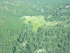
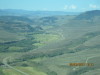
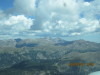
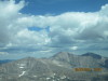
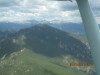
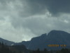
| Pressure feeding Pinewood Reservoir, with electric generator at the bottom, 08/27/2011 | Looking W over Wild Basin, to the Continental Divide. The south shoulder of Longs Peak is on the right, 08/27/2011 | US-36, looking NW, in the morning shadow, SE of Estes Park, CO, 08/27/2011 | Pierson Park on the left, first sighting of Elk Park, just beyond the close ridge, 08/27/2011 | Elk Park Airport is in the narrow meadow in the upper right, 08/27/2011 | ||
| ||||||
|
|
|
|
|
||
| ||||||
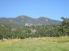
| Pikes Peak is visible in the haze ~100 miles SE of Elk Park. Usually Pikes Peak is in clear, sharp focus, 08/27/2011 | Mount Evans is visible in the haze ~40 miles S of Elk Park, 08/27/2011 | Heliport and camp E of Elk Park, 08/27/2011 | Elk Park Ranch Airport (34CD), Colorado, looking W 1, 7900 MSL, 1800' length, 08/27/2011 | Elk Park Ranch Airport (34CD), Colorado, looking W 2, 7900 MSL, 1800' length, 08/27/2011 | ||
| ||||||
|
|
|

|

|
||
| ||||||
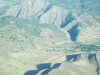
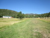
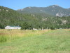
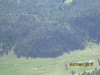
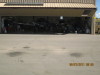
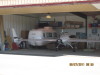
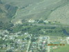
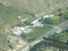
| Elk Park, note the trees on departure at the east end of the runway, 08/27/2011 | N9513G and Jer/ at the W end of Elk Park Ranch Airport (34CD), Colorado 1, 08/27/2011 | N9513G and Jer/ at the W end of Elk Park Ranch Airport (34CD), Colorado 2, 08/27/2011 | Steve Smitherman is home at Elk Park when the P-51 Mustang weather vane is displayed on the deck, 08/27/2011 | Elk Park, looking NE across the runway from the deck, spotting scope for elk, 08/27/2011 | ||
| ||||||
|
|
|
|
|
||
| ||||||
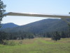
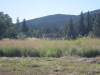
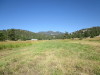
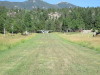
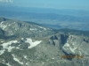
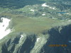
| Elk Park Airport (34CD), Colorado, looking E. Departure is down the runway to the trees, then a 135 degree right turn, climbing over Pierson Park to the right, 08/27/2011 | Elk Park Runway, looking E 1, 08/27/2011 | Elk Park Runway, looking E 2, 08/27/2011 | Elk Park Runway, looking E 3, 08/27/2011 | Elk Park Runway, looking E 4, 08/27/2011 | ||
| ||||||
|
|
|
|
|
||
| ||||||
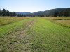
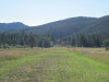
| Elk Park Runway, looking E 5, 08/27/2011 | Elk Park Runway, looking E 6. It is wet below here. Note the rock and tree obstacles on departure, 08/27/2011 | Elk Park Runway, looking W 1, 08/27/2011 | Elk Park Runway, looking W 2, 08/27/2011 | Elk Park Runway, looking W 3, 08/27/2011 | ||
| ||||||
|
|
|
|
|
||
| ||||||
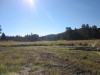
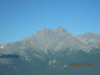
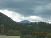
| Elk Park Runway, looking W 4, 08/27/2011 | Elk Park Runway, looking W 5, 08/27/2011 | Future pilot visiting at Elk Park, likes the Cessna 206, 08/27/2011 | Old N-S runway 1 mile W of Elk Park, 1 mile S of Pierson Park, 08/27/2011 | Longs Peak, 08/27/2011 | ||
| ||||||
|
|
|
|
|
||
| ||||||
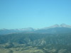
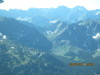
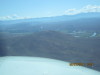
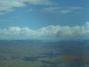
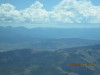
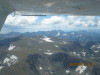
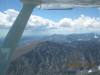
| Wild Basin turnoff into Rocky Mountain National Park (RMNP), looking W, 08/27/2011 | Twin Sisters Mountain, looking N, 08/27/2011 | Lake Estes in the upper right, looking NE up CO-7, 08/27/2011 | Looking SW from Longs Peak toward Grays and Toreys Peaks (twin peaks in left corner), 08/27/2011 | Crossing the Continental Divide, S of Longs Peak, Granby in the distance, 08/27/2011 | ||
| ||||||
|
|
|
|
|
||
| ||||||
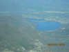
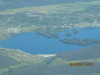
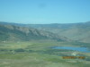
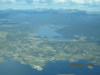
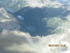
| Ponds in the high cairns on top of the Continental Divide, 08/27/2011 | Indian Peaks Wilderness, looking S from Longs Peak, 08/27/2011 | Grand Lake, then left to Shadow Mountain Reservoir, 1 looking W, 08/27/2011 | Grand Lake, then left to Shadow Mountain Reservoir, 2 looking W, 08/27/2011 | Islands at the south end of Shadow Mountain Reservoir, 08/27/2011 | ||
| ||||||
|
|
|
|
|
||
| ||||||
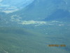
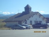
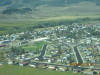
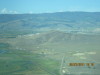
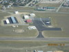
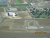
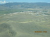
| Granby, Colorado, looking SW, 08/27/2011 | Turning right downwind to land GNB RWY 27, 08/27/2011 | Granby Airport (GNB), Colorado, final RWY 27, 08/27/2011 | P-51 Mustang on display at GNB after pancake breakfast, 08/27/2011 | Granby (GNB) airport terminal building from the S ramp, looking NE, 08/27/2011 | ||
| ||||||
|
|
|
|
|
||
| ||||||
| N9513G on the S ramp at GNB, looking W, 08/27/2011 | Rare Twin Comanche at GNB, 08/27/2011 | Velocity at GNB, 08/27/2011 | Granby, CO, after departure RWY 27 from GNB 1, looking SW over town, 08/27/2011 | Granby, CO, after departure RWY 27 from GNB 2, looking NE toward Lake Granby, 08/27/2011 | ||
| ||||||
|
|
|
|
|
||
| ||||||
| Granby, CO, after departure RWY 27 from GNB 3, looking W toward Hot Sulphur Springs, 08/27/2011 | Looking W on US-40 to Hot Sulphur Springs, CO, 08/27/2011 | The hot springs is across the river (right) at Hot Sulphur Springs 1, 08/27/2011 | The hot springs is across the river at Hot Sulphur Springs 2, 08/27/2011 | The hot springs is across the river at Hot Sulphur Springs 3, 08/27/2011 | ||
| ||||||
|
|
|
|
|
||
| ||||||
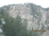
| Looking W on US-40 to Kremmling, CO. The airport is behind the mountain, and we lose sight of the airport on right downwind turning base, 08/27/2011 | Yes, this mountain is in the pattern at Kremmling, 08/27/2011 | Kremmling right upwind RWY 27, 08/27/2011 | Kremmling RWY 27 teacup turnaround, 08/27/2011 | Kremmling midfield and ramp, looking N, note two jets now, 3 jets later, 08/27/2011 | ||
| ||||||
|
|
|
|
|
||
| ||||||
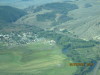
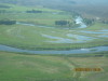
| Kremmling RWY 9 teacup turnaround, 08/27/2011 | Kremmling turning right downwind RWY 27, 08/27/2011 | Kremmling right downwind RWY 27, the mountain is in the pattern, 08/27/2011 | Kremmling right downwind RWY 27, about to lose sight of RWY 27, 08/27/2011 | The Colorado River is running full just east Kremmling, 08/27/2011 | ||
| ||||||
|
|
|
|
|
||
| ||||||
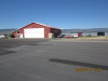
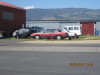
| Kremmling right base RWY 27, turning final, 08/27/2011 | McElroy Field, Kremmling Airport (20V), Colorado, final RWY 27, 08/27/2011 | Kremmling FBO, courtesy car is the dark colored Buick 1, 08/27/2011 | Kremmling FBO, courtesy car is the dark colored Buick 2, 08/27/2011 | Kremmling Airport access gate, inbound, 08/27/2011 | ||
| ||||||
|
|
|
|
|
||
| ||||||
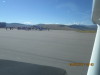
| Oregon pilot with wife attempted a hot/fast landing with a crosswind. The late go-around was unsuccessful. Cessna 182 RG, 08/27/2011 | Kremmling, 4 airplanes on the main ramp, 08/27/2011 | Kremmling, 4 airplanes on the main ramp, 1 jet on the private ramp, so there are 3 jets and 2 small Cessnas flyable, 08/27/2011 | Kremmling departing RWY 9, 08/27/2011 | Eastbound over Hot Sulphur Springs, CO, looking SE, Corona Pass in the far distance, 08/27/2011 | ||
| ||||||
|
|
|
|
|
||
| ||||||
| Hot Sulphur Springs, CO, hot springs is across the river to the right, 08/27/2011 | Sol Vista Basin, formerly Silver Creek Ski Area center left (S of Granby), Corona Pass on the horizon, 08/27/2011 | Longs Peak right, Helmut Peak and Sprague Pass left, looking E, 08/27/2011 | Over Lake Granby, looking N over Shadow Mountain Reservoir toward Grand Lake, CO 1, 08/27/2011 | Over Lake Granby, looking N over Shadow Mountain Reservoir toward Grand Lake, CO 2, 08/27/2011 | ||
| ||||||
|
|
|
|
|
||
| ||||||
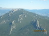
| Helmut Peak on the left, Longs Peak on the right, 08/27/2011 | South of Longs Peak is Buchannan Pass, located at Sawtooth Mountain 1, 08/27/2011 | South of Longs Peak is Buchannan Pass, located at Sawtooth Mountain 2, 08/27/2011 | South of Longs Peak is Buchannan Pass, located at Sawtooth Mountain 3, 08/27/2011 | Buchannan Pass, at the left base of Sawtooth Mountain, looking E, 08/27/2011 | ||
| ||||||
|
|
|
|
|
||
| ||||||
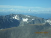
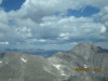
| Lake Granby, looking E toward campground at Arapaho Bay, 08/27/2011 | Colorado River, draining from Shadow Mountain Reservoir into Lake Granby, looking NW, 08/27/2011 | Longs Peak (14,256 MSL) left, Mount Meeker (13,911) right, looking E, 08/27/2011 | Indian Peaks Wilderness, looking S across Buchannan Pass, 08/27/2011 | Left to right: Mount Lady Washington, Longs Peak, Mount Meeker, looking E, 08/27/2011 | ||
| ||||||
|
|
|
|
|
||
| ||||||
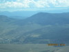
| High mountain lakes SW of Longs Peak in RMNP, 08/27/2011 | Over Wild Basin after crossing the Continental Divide eastbound, S of Longs Peak, N of Buchannan Pass, 08/27/2011 | Longs Peak, looking N. Note the beaver's nose on the right side of the peak, 08/27/2011 | Pierson Park and Elk Park Airport are off the nose, 08/27/2011 | Pierson Park, looking ESE, 08/27/2011 | ||
| ||||||
|
|
|
|
|
||
| ||||||
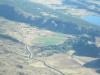
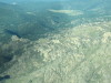
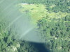
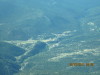
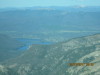
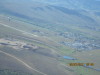
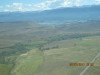
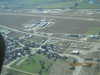
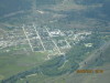
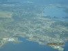
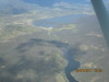
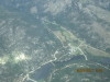
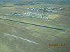
| Twin Sisters (11,428 MSL), looking N to the Never Summer Range, 08/27/2011 | Elk Park Airport (34CD), looking N, 08/27/2011 | 1 mile downstream from Elk Park Airport, looking N, note white circle helipad 08/27/2011 | Looking NE across Boyd Lake to Fort Collins - Loveland Airport (FNL), 08/27/2011 | Runway 15/33 repaving in progress 1, 08/27/2011 | ||
| ||||||
|
|
|
|
|
||
| ||||||
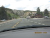
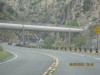
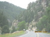
| Runway 15/33 repaving in progress 2, 08/27/2011 | Runway 15/33 repaving in progress 3, 08/27/2011 | Runway 15/33 repaving in progress 4, 08/27/2011 | Big Thompson Canyon 1, driving US-34 08/27/2011 | Big Thompson Canyon 2, driving US-34 08/27/2011 | ||
| |||
|
|
||
| |||
| The beaver on Longs Peak 1, see the "nose", ears, back and tail, 08/27/2011 | The beaver on Longs Peak 2, see the "nose", ears, back and tail, 08/27/2011 | ||