 | ||||||
|
|
|
|
|
||
| ||||||
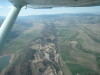
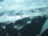
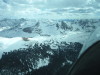
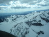
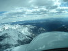
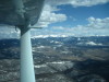
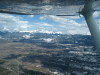
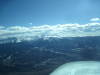
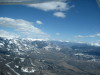
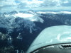
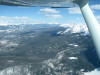
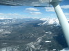
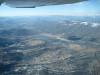
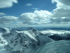
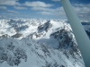
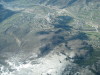
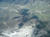
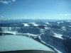
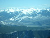
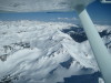
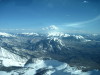
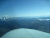
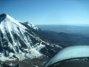
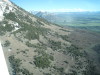
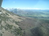
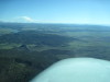
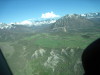
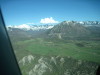
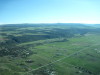
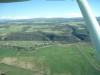
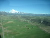
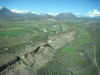
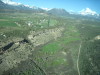
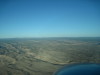
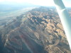
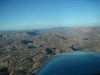
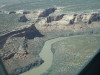
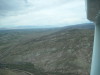
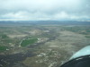
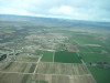
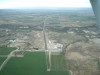
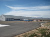
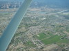
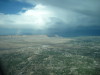
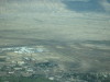
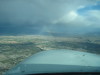
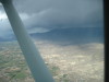
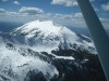
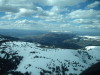
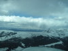
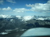
| Private airstrip W of Loveland, CO, looking N to N/S runway on ridge in center. | Over US-34, W of Loveland, looking W to Carter Lake. 05/13/11 | Elk Park Airport, looking E, hangar SW corner of meadow. 05/13/11 | Continental Divide, looking SW, S of Longs Peak. 05/13/11 | Approaching the Continental Divide from the E. 1 05/13/11 | ||
| ||||||
|
|
|
|
|
||
| ||||||
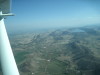
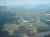
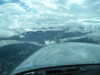
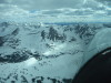
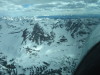
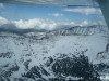
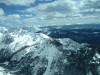
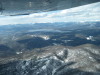
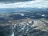
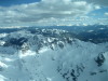
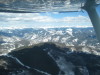
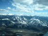
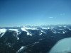
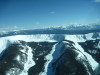
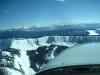
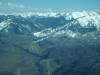
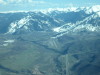
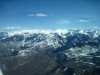
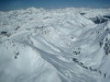
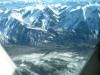
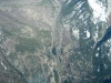
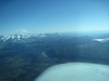
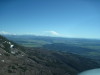
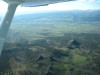
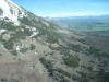
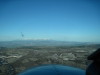
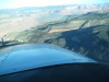
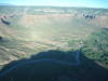
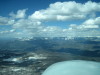
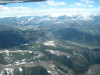
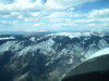
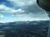
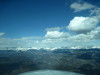
| Approaching the Continental Divide from the E. 2 05/13/11 | Approaching the Continental Divide from the E. 3 05/13/11 | Approaching the Continental Divide from the E. 4 05/13/11 | Approaching the Continental Divide from the E. 5 05/13/11 | Approaching the Continental Divide from the E. 6 05/13/11 | ||
| ||||||
|

|
|
|
|
||
| ||||||
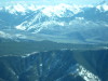
| Buchannan Pass, looking E from the W side of the divide. 05/13/11 | Over Buchannan Pass, looking WNW to Lake Granby. 05/13/11 | Crossing the Continental Divide W bound at Buchannan Pass. 05/13/11 | Looking S to Winter Park Ski Area. Corona Pass on the left. 05/13/11 | Looking NW to Lake Granby. 1 05/13/11 | ||
| ||||||
|
|
|
|
|
||
| ||||||
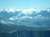
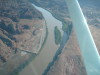
| Notice that Lake Granby is still frozen. 05/13/11 | West of the Continental Divide, looking SW to the Gore Range. 05/13/11 | Fraiser Valley, CO, looking S to Winter Park Ski Area. Corona Pass on the left. 05/13/11 | N of Kremmling, CO, looking SW over the Gore Range "bench" toward Eagle, CO. 05/13/11 | Over the Blue River, N of Kremmling, looking SE to Lake Dillon and I-70. 05/13/11 | ||
| ||||||
|
|
|
|
|
||
| ||||||
| Looking S, approaching the valley with Hagerman Pass and Ruedi Reservoir. 05/13/11 | Looking SE toward Hagerman Pass and Mount Massive. 1 05/13/11 | Looking SE toward Hagerman Pass and Mount Massive. 2 05/13/11 | Green Mountain Reservoir, looking NW toward Kremmling and Rabbit Ears Pass. 05/13/11 | At the Gore Range, looking SW to Aspen, Red Table Mountain and Mount Sopris, CO. 05/13/11 | ||
| ||||||
|
|
|
|
|
||
| ||||||
| 13,000+ MSL peaks S of Kremmling, CO. 05/13/11 | Vail Ski Area, CO. 1 05/13/11 | Vail Ski Area, CO. 2 05/13/11 | Beaver Creek Ski Area, CO. 05/13/11 | I-70 at Edwards, CO, looking NNW. 1 05/13/11 | ||
| ||||||
|
|
|
|
|
||
| ||||||
| I-70 at Edwards, CO, looking NNW. 2 05/13/11 | Red Table Mountain, looking SW to Mount Sporis. 1 05/13/11 | Red Table Mountain. 05/13/11 | Red Table Mountain, looking SW to Mount Sopris. 2 05/13/11 | Red Table Mountain, looking SW to Maroon Bells, Aspen, CO. 05/13/11 | ||
| ||||||
|
|
|
|
|
||
| ||||||
| Aspen, CO, Ajax Mountain Ski Area. 05/13/11 | Aspen, CO, Ajax Mountain Ski Area. 05/13/11 | Aspen, CO, Ajax Mountain Ski Area. 05/13/11 | Roaring Fork Valley, Aspen Airport to Ajax, looking SE. 1 05/13/11 | Roaring Fork Valley, Aspen Airport to Ajax, looking SE. 2 05/13/11 | ||
| ||||||
|
|
|
|
|
||
| ||||||
| Aspen Snowmass Ski Area, CO. 05/13/11 | N9513G, C206, stabilized EGT and CHT at 12,500 MSL, 10.0 GPH. Love those GAMIjectors! 05/13/11 | Mount Sopris, looking NW toward Rifle, CO. 05/13/11 | 14,000+ MSL peak W of Aspen, looking E. 05/13/11 | W of Aspen, looking SW toward the Ragged Mountains and Montrose, CO. 05/13/11 | ||
| ||||||
|
|
|
|
|
||
| ||||||
| Looking SE toward Castle Peak, 14,265 MSL. 1 05/13/11 | Looking SE toward Castle Peak, 14,265 MSL. 2 05/13/11 | Marble Airport, CO. Looking S. The airstrip is L to R, just beyond the water. 05/13/11 | Marble Airport, CO. Looking E. 05/13/11 | Mount Gunnison, looking S from over Marble Airport. 05/13/11 | ||
| ||||||
|
|
|
|
|
||
| ||||||
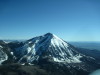
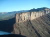
| Mount Lamborn, 11,396 MSL, over McClure Pass, looking SW. 1 05/13/11 | Mount Lamborn, 11,396 MSL, over McClure Pass, looking SW. 2 05/13/11 | Mount Lamborn, 11,396 MSL, looking SW, E of Paonia, CO. 05/13/11 | Mount Lamborn, looking SW across the Black Canyon of the Gunnison toward Montrose, CO. 05/13/11 | Crawford Reservoir, far horizon is Telluride and Lone Cone. 05/13/11 | ||
| ||||||
|
|
|
|
|
||
| ||||||
| Grand Mesa, Looking NW from Mount Lamborn, over Hotchkiss, CO. 05/13/11 | Needle Rock, Crawford, CO. 1 05/13/11 | Needle Rock, Crawford, CO. 2 05/13/11 | Needle Rock, Crawford, CO. 3 05/13/11 | Crawford Reservoir, CO. 05/13/11 | ||
| ||||||
|
|
|
|
|
||
| ||||||
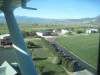
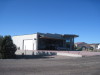
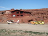
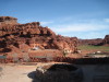
| Needle Rock, looking E. Singer Joe Cocker has a Tudor Mansion N of the rock. 1 05/13/11 | Needle Rock, looking E. Singer Joe Cocker has a Tudor Mansion N of the rock. 2 05/13/11 | Crawford Airport (99V), CO, 6470 MSL, RWY 7-25, looking SW. The ridge is the Black Canyon of the Gunnison. 05/13/11 | Crawford Airport (99V), CO, left downwind abeam RWY 7. 05/13/11 | Crawford Airport (99V), CO, left base RWY 7. 1 05/13/11 | ||
| ||||||
|
|
|
|
|
||
| ||||||
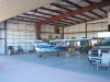
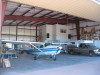
| Crawford Airport (99V), CO, left base RWY 7. 2 05/13/11 | Crawford Airport (99V), CO, final RWY 7. 05/13/11 | Crawford Airport (99V), CO, hangars, houses and trout pond N of the runway. 05/13/11 | Crawford Airport (99V), CO, N9513G in the hangar. 05/13/11 | Crawford Airport (99V), CO, N9513G in the hangar. 05/13/11 | ||
| ||||||
|
|
|
|
|
||
| ||||||
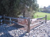
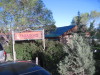
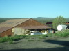
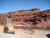
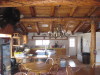
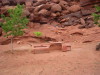
| Crawford Airport (99V), CO, Taxiway sign to trout pond. 05/13/11 | Hangar with attached house. 05/13/11 | Well implemented, sunken tiedown. 05/13/11 | Crawford, CO, Vagabond Restaurant. Upscale cuisine changes every 2 weeks. 05/13/11 | Hangar with attached house. 05/14/11 | ||
| ||||||
|
|
|
|
|
||
| ||||||
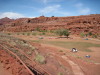
| N9513G, preflighted for early morning departure. 05/14/11 | Crawford Airport (99V), CAP SGS-2-33 on the trailer. 05/14/11 | West of Delta, Uncompahgre Plateau. 05/14/11 | La Sal Mountains, looking W from near Gateway, CO. 05/14/11 | Hubbard Airport (9CO3) and Gateway, CO are in this valley. 05/14/11 | ||
| ||||||
|
|
|
|
|
||
| ||||||
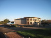
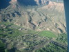
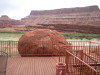
| Hubbard Airport (9CO3) and Gateway, CO. White dot is a hangar at mid-field. 05/14/11 | Mesa N of Gateway, CO. 05/14/11 | Hubbard Airport (9CO3), looking S. Gateway Canyons Resort http://www.gatewaycanyons.com/ , will pickup from the airport, 122.8. White dot is a hangar at mid-field. 05/14/11 | Moab, UT, "fins", looking S. 05/14/11 | Moab, UT, downtown, looking N. 05/14/11 | ||
| ||||||
|
|
|
|
|
||
| ||||||
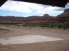
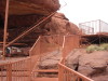
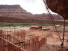
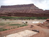
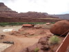
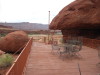
| W of Moab, looking S. Note jeep trails. 05/14/11 | W of Moab, approaching Caveman Ranch (left of "blue" ponds). 05/14/11 | Caveman Ranch Airport (UT68), looking E. 05/14/11 | Caveman Ranch Airport (UT68), looking NNW. Restaurant. 05/14/11 | Caveman Restaurant W deck, looking NNW to "cave" motel rooms that have patio doors. 05/14/11 | ||
| ||||||
|
|
|
|
|
||
| ||||||
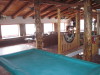
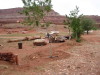
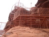
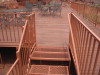
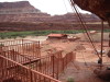
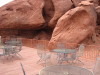
| Caveman Restaurant N deck, looking NNE to owner's home. Note steps and metal deck to right and above truck. 05/14/11 | Caveman Ranch camping area. Large white ball is at the baseball diamond. 05/14/11 | Airplane takeoff to the West. Colorado River camping area behind the airplanes and wind sock.05/14/11 | Caveman Ranch, inside the lodge. 1 05/14/11 | Caveman Ranch, inside the lodge. 2 05/14/11 | ||
| ||||||
|
|
|
|
|
||
| ||||||
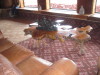
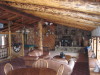
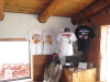
| Caveman Ranch, inside the lodge. 3 05/14/11 | Caveman Ranch, inside the lodge. 4 05/14/11 | Caveman Ranch Lodge, Kitchen 05/14/11 | Caveman Ranch Lodge, Motel room caves. 1 05/14/11 | Caveman Ranch Lodge, Motel room caves. 2 05/14/11 | ||
| ||||||
|
|
|
|
|
||
| ||||||
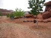
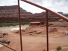
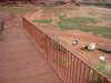
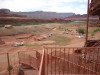
| Caveman Ranch, looking ESE across the campground toward the lodge and airstrip. 05/14/11 | Airplane taxiing from the campground to the airstrip on the right. 05/14/11 | Kids play area, swing set. 05/14/11 | Kids play area, with targets. 05/14/11 | Climbing the steps to the observation decks. 1 05/14/11 | ||
| ||||||
|
|
|
|
|
||
| ||||||
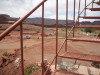
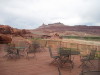
| Lower observation deck, stairs to the upper observation deck. 05/14/11 | Caveman Ranch Lodge, looking from the observation deck to the airstrip. 05/14/11 | Final climb to the upper observation deck. 05/14/11 | Looking down some of the stairs. 05/14/11 | Upper observation deck. 05/14/11 | ||
| ||||||
|
|
|
|
|
||
| ||||||
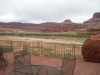
| Looking from the upper observation deck to the horse barn and the NE end of the airstrip. 05/14/11 | Panorama around Caveman Ranch from upper observation deck. 1 05/14/11 | Panorama around Caveman Ranch from upper observation deck. 2 05/14/11 | Panorama around Caveman Ranch from upper observation deck. 3 05/14/11 | Panorama around Caveman Ranch from upper observation deck. 4 05/14/11 | ||
| ||||||
|
|
|
|
|
||
| ||||||
| Panorama around Caveman Ranch from upper observation deck. 5 05/14/11 | Panorama around Caveman Ranch from upper observation deck. 6 05/14/11 | Panorama around Caveman Ranch from upper observation deck. 7 05/14/11 | Panorama around Caveman Ranch from upper observation deck. 8 05/14/11 | Panorama around Caveman Ranch from upper observation deck. 9 05/14/11 | ||
| ||||||
|
|
|
|
|
||
| ||||||
| Panorama around Caveman Ranch from upper observation deck. 10 05/14/11 | Jetboat headed for Moab on the Colorado River. Fuzzy. 05/14/11 | Caveman Ranch, Mining equipment and windmill. 05/14/11 | Caveman Ranch, note logo on windmill. 05/14/11 | Colorado River, between Moab and Grand Junction, CO. 05/14/11 | ||
| ||||||
|
|
|
|
|
||
| ||||||
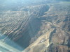
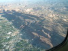
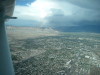
| Colorado River, between Moab and Grand Junction, CO. Note rafters. 05/14/11 | I-70, looking NE to the Book Cliffs N of Grand Junction, CO. 05/14/11 | Mack Mesa Airport (C07), CO, is the white buildings left of the water. 05/14/11 | Mack Mesa Airport (C07) has RWY 7/25. 05/14/11 | Mack Mesa Airport (C07) left crosswind for RWY 7. 05/14/11 | ||
| ||||||
|
|
|
|

|
||
| ||||||
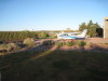
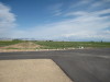
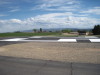
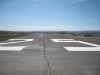
| Mack Mesa Airport (C07), 800' of grass, if you are so inclined. 05/14/11 | "The Numbers" for RWY 25. 05/14/11 | Mack Mesa Airport (C07), looking down RWY 25. 05/14/11 | N9513G on the ground at Mack Mesa for airport BBQ dinner. 05/14/11 | "Peter's Laws": The Creed of the Sociopathic Obsessive Compulsive, at C07. 05/14/11 | ||
| ||||||
|
|
|
|
|
||
| ||||||
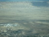
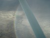
| Over Grand Junction, CO, looking SW to the racetrack. 05/14/11 | Over Grand Junction, CO, looking SE toward the Black Canyon and Crawford. 05/14/11 | Grand Junction Airport (KGJT), CO, looking NE. 1 Fuzzy 05/14/11 | Grand Junction Airport (KGJT), CO, looking NE. 2 Fuzzy 05/14/11 | Note the start of the rainbow. 05/14/11 | ||
| ||||||
|
|
|
|
|
||
| ||||||
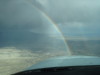
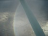
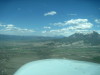
| The weather moves quickly. 05/14/11 | Grand Junction, CO, looking E toward Land's End on Grand Mesa. 05/14/11 | Note a better defined rainbow. 05/14/11 | Note rainbow curving under me. In the air you can get a "full round" rainbow, called a "Glory". 1 05/14/11 | Note rainbow curving under me. In the air you can get a "full round" rainbow, called a "Glory". 2 05/14/11 | ||
| ||||||
|
|
|
|
|
||
| ||||||
| Mount Lamborn, looking NE toward the Ragged Mountains, and Marble, CO beyond. 05/14/11 | Mount Sopris, looking NW toward Glenwood Springs, CO. 05/15/11 | Red Table Mountain, looking NE. Red Table VOR and weather radar are on top of this ridge. 05/15/11 | Aspen, Roaring Fork Valley, looking S to Aspen Airport (KASE), CO, the far "straight road". Aspen Snowmass Ski Area on the right. 05/15/11 | Red Table Mountain, looking NNW toward the Flat Tops Wilderness area N of Glenwood Springs, CO. 05/15/11 | ||
| ||||||
|
|
|
|
|
||
| ||||||
| Red Table Mountain, looking N. You can see the weather radar. 05/15/11 | Longs Peak is at the far horizon, looking NE over he "bench" on the Gore Range, NE of Eagle Airport (KEGE), CO. 05/15/11 | Corona Pass, looking SE from the West side. Winter Park Ski Area on the right. 05/15/11 | Longs Peak on the left, Buchannan Pass is at the "sawtooth mountain" in mid-frame. 05/15/11 | Buchannan Pass is at the "sawtooth mountain" at mid-frame. 05/15/11 | ||