 | ||||||
|
|
|
|
|
||
| ||||||
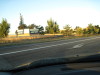
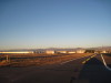
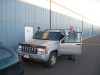
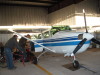
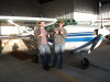
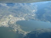
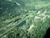
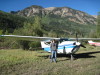
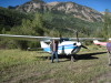
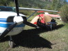
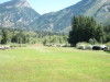
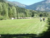
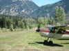
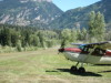
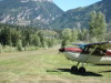
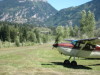
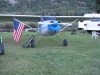
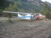
| Fort Collins - Loveland (FNL) Airport sign, Loveland, Colorado. | FNL looking over that hangars, W to Long's Peak. | Jake (L) and Micah (R) ready empty the Jeep into the airplane. | Jake and Micah loading the airplane, N9513G, C206. | Micah and Jake successfully loaded N9513G, C206. | ||
| ||||||
|
|
|
|
|
||
| ||||||
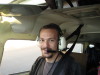
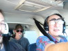
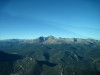
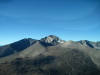
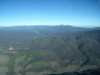
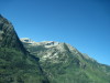
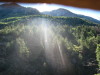
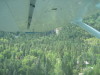
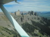
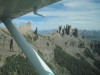
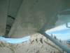
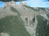
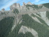
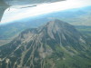
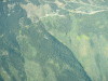
| Micah flying. | Micah, Jake and Jer/ enroute to Marble, CO. | Turning SW from FNL. Long's Peak and the Continental Divide beckon. | Long's Peak. Note the "point" just left of the peak. Our indian friends tell us this is the "beaver" on Long's Peak. | The beaver's nose points up... Moving to the left you should be able to make out the ears, back and tail. We are looking SW into the "boulder field", toward the "keyhole". | ||
| ||||||
|
|
|
|
|
||
| ||||||
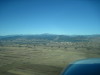
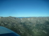
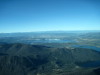
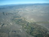
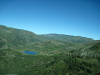
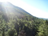
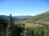
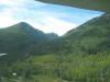
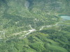
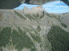
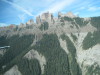
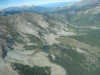
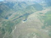
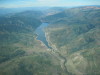
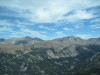
| From the boulder field, looking W across the continental divide. | W of Estes Park, CO, Gore range in the distance, L to R: Lake Granby, Shadow Mountain reservoir, Grand Lake. | Grand Lake, CO, looking toward the North shore. | Willow Creek Pass, looking NW into North Park/Walden. | 12,500 MSL, looking W across the Colorado River into RWY 27 at Kremmling, CO. | ||
| ||||||
|
|
|
|
|
||
| ||||||
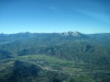
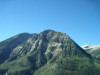
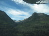
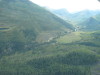
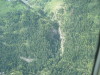
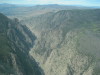
| Mount Sporis, looking SW across El Jebel. | Over El Jebel, looking W to Carbondale. | Mount Sporis, looking up the Crystal River. The Ragged Mountains, over McClure Pass to Mount Lamborn. Marble, Colorado is at the base of the | Deep canyons: Avalanche Creek is on the left. Crystal River to Marble is on the right. | Redstone Castle in on the far side of the clearing. | ||
| ||||||
|
|
|
|
|
||
| ||||||
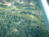
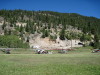
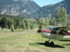
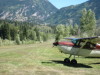
| Marble Airport, W end, looking N. | Marble Airport, E end, looking N. We tied down and camped just to the right of the far left airplane. | The Marble mine's shipping staging are is the white area. | Marble Airport, looking W toward McClure Pass. | Marble Airport, left downwind, landing to the E. | ||
| ||||||
|
|
|
|
|
||
| ||||||
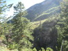
| Dust on the runway is from a departing airplane. We camped next to the airplane at the R edge of the dust cloud. | Note the diagonal cut from the left going up to McClure Pass. | The lake is up on the ridge. Valley floor is to the left. | Marble Airport, on approach, looking up at the Ragged Mountains. | There is a waterfall in the canyon on the east side. More pictures later. | ||
| ||||||
|
|
|
|
|
||
| ||||||
| Left Base, landing E, Marble. | Final approach, landing E, Marble. 1 | Final approach, landing E, Marble. 2 | Final approach, landing E, Marble. 3 | Final approach, landing E, Marble. 4 | ||
| ||||||
|
|
|
|
|
||
| ||||||
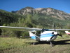
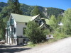
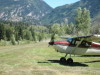
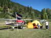
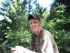
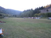
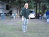
| N9513G parked at Marble. | Jake at Marble. | Micah at Marble. | Camp setup at Marble, in the shade. | Marble Museum is on the register of historic places. | ||
| ||||||
|
|
|
|
|
||
| ||||||
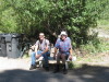
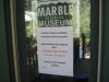
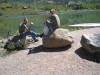
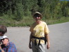
| Micah and Jake at the Marble Museum. This is also the Marble Charter School. | Micah and Jake on the marble bench. | Micah and Jer/ on the marble bench. | The museum hours are posted, it is 11:35 AM, Saturday, 09/11/2010, but the museum is not open. | Lunch at Beaver Lake, Marble, Colorado. | ||
| ||||||
|
|
|
|
|
||
| ||||||
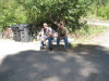
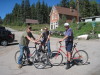
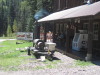
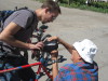
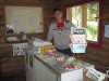
| We brought bikes! Marble Museum is up the road 4 blocks. | The Cook Shack, Woody's Bar-B-Que at Marble, CO, 970 963-4090. Note old-timer on the porch. | Technical difficulties. The seat broke. | Bob supervising. | Marble General Store. | ||
| ||||||
|
|
|
|
|
||
| ||||||
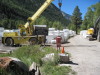
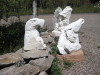
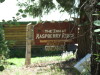
| Marble Mill Site. Marble stored for shipping by truck. | Marble Park stage. Musicians plan and they put a screen and show movies. | The Eagle at the Marble Sculptor Studio. | The Inn at Raspberry Ridge. About 1 mile east of Marble Airport. | The Inn at Raspberry Ridge. About 1 mile east of Marble Airport. 970 704-278. | ||
| ||||||
|
|
|
|
|
||
| ||||||
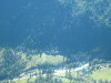
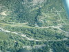
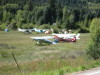
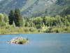
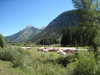
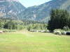
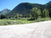
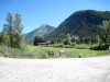
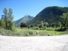
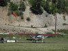
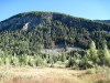
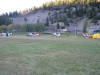
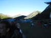
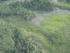
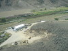
| Marble Airport/runway/planes (white dots) can be seen from the road, looking W. | Marble Airport "runway end" marker line is made of white marble dust. | Airplane camping on Marble Airport. N7390K, N9513G on the far side. | Beaver pond at Marble Airport. The white dots are at our airplane camp site. | Closeup: Beaver pond at Marble Airport. The white dots are at our airplane camp site. | ||
| ||||||
|
|
|
|
|
||
| ||||||
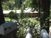
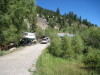
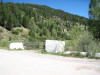
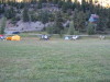
| Marble Airport camping. Owner's trailers are in the far trees. Note the wind sock... the base is a 3' square piece of marble with a hole in it for the post. | A sailboat next to Marble Airport. | The "berm" that we fly over when departing W from Marble. Note the mailboxes on the road and the marble blocks with the gate on the airport access road the left. | Marble Airport, looking E from the berm. Airplanes takeoff toward this position. "No Parking" on the berm. | Closeup: Marble Airport, looking E from the berm. Airplanes takeoff toward this position. "No Parking" on the berm. | ||
| ||||||
|
|
|
|
|
||
| ||||||
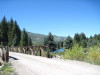
| Looking across the berm. The road to the right leads to the trailhead for the waterfall. | Marble Airport, airplane landing. 1 | Marble Airport, airplane landing. 2 | Marble Airport, airplane taxiing to the far E end for camping. | Marble Airport access road gate from the berm. | ||
| ||||||
|
|
|
|
|
||
| ||||||
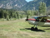
| Across the berm to the west is the river and a pond. | Marble Airport, camping on the N side, across from the owner's trailers. | Marble Airport camping. Note the wind sock... the base is a 3' square piece of marble with a hole in it for the post. | Closeup of wind sock base. | Airplane taking off from Marble. sequence 1 | ||
| ||||||
|
|
|
|
|
||
| ||||||
| Airplane taking off from Marble. sequence 2 | Airplane taking off from Marble. sequence 3 | Airplane taking off from Marble. sequence 4 | Airplane taking off from Marble. sequence 5 | Airplane taking off from Marble. sequence 6 | ||
| ||||||
|
|
|

|
|
||
| ||||||
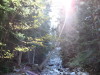
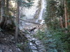
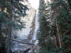
| Airplane taking off from Marble. sequence 7 | Airplane taking off from Marble. sequence 8 | Famous Oshkosh airplane camper "redbird", N__39X, C172 with 180hp engine, CS prop, dog "Molly". | Approaching Marble Falls on the hike up. | Creek below Marble Falls. | ||
| ||||||

|
|
|
|
|
||
| ||||||
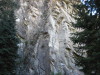
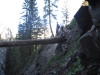
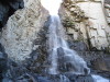
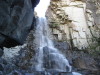
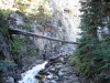
| Base of Marble Falls. | Rock wall above Marble Falls. | Marble Falls. | Jake on bridge at Marble Falls. 1 | Jake on bridge at Marble Falls. 2 | ||
| ||||||

|

|
|

|

|
||
| ||||||
| Jake again on bridge at Marble Falls. 1 | Jake again on bridge at Marble Falls. 2 | Marble Falls. 1 | Marble Falls. 2 | Marble Falls. 3 | ||
| ||||||
|

|
|
|

|
||
| ||||||
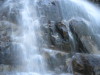
| Marble Falls. 4 | Marble Falls. 5 | Marble Falls. 6 | Marble Falls. 7 | Micah on bridge at Marble Falls. 1 | ||
| ||||||

|
|
|

|
|
||
| ||||||
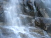
| Micah on bridge at Marble Falls. 2 | Jake again on bridge at Marble Falls. 3 | Jake again on bridge at Marble Falls. 4 | Jake again on bridge at Marble Falls. 5 | Marble Falls. 8 | ||
| ||||||
|
|
|
|
|
||
| ||||||
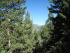
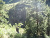
| Hiking in the woods around the falls. 1 | Hiking in the woods around the falls. 2 | Rest break, Jake checking the GPS. | Hiking in the woods around the falls. 3 | Hiking in the woods around the falls. 4 | ||
| ||||||
|

|

|

|
|
||
| ||||||
| Above Marble Falls, trying to find an overlook. 1 | Above Marble Falls. 2 | Above Marble Falls. 3 | Above Marble Falls. 4 | Above Marble Falls. 5 | ||
| ||||||

|

|
|
|
|
||
| ||||||
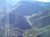
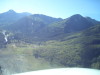
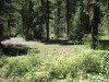
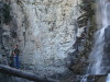
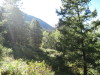
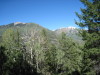
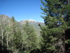
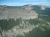
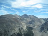
| Jake on the hike down from Marble Falls. | Micah on the hike down from Marble Falls. | Looking SW to the Ragged Mountains. 1 | Looking SW to the Ragged Mountains. 2 | Below Marble Falls, looking NW to McClure Pass. Note diagonal road cut. | ||
| ||||||

|

|

|
|

|
||
| ||||||
| Jake on the trail. | Micah on the trail. | The falls are in the shadow already! | View from the trail. 1 | View from the trail. 2 | ||
| ||||||
|
|
|
|
|
||
| ||||||
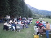
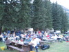
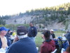
| Marble Historical Society, Marble Airport, BBQ Supper, Saturday evening, 09/11/2010. 1 | Marble Historical Society, Marble Airport, BBQ Supper, Saturday evening, 09/11/2010. 1 | Fly in, bring your musical instruments! | Sunset panorama W to N to E at Marble Airport. 1 | Sunset panorama W to N to E at Marble Airport. 2 | ||
| ||||||
|
|
|
|
|
||
| ||||||
| Sunset panorama W to N to E at Marble Airport. 3 | Sunset panorama W to N to E at Marble Airport. 4 Note the shadow line on the mountain. | Our hostess, Mrs. Gallegos. | Our host, Mr. Gallegos. | Marble Airport, sunrise, Sunday, 09/12/2010. | ||
| ||||||
|
|
|
|
|
||
| ||||||
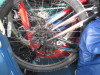
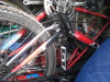
| Frost! | Big hike yesterday to the falls... still sleeping, burning daylight! | 3 bicycles and camping gear packed into N9513G. | Yes, some bikes are upside down. | Marble Falls are under the wingtip. | ||
| ||||||
|
|
|

|
|
||
| ||||||
| Marble Falls are up this valley, looking S. | Circling for altitude over Marble before departing for Schofield Pass. | Looking down into the trees. | Crystal River, looking S. L goes to Marble, R goes to McClure Pass and Paonia. | Looking E. Marble Airport is the grass just beyond the water. | ||
| ||||||
|
|
|
|

|
||
| ||||||
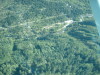
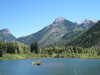
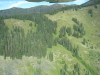
| Avalanche debris... trees pushed down. | Marble Falls, upper and lower canyon. | Marble, Colorado, looking NE, Beaver Lake on the right. | Marble, Colorado, looking NW. The airport is the straight line at the upper left. | Marble, Colorado, looking W. The airport is the straight line at the upper left. | ||
| ||||||
|
|

|

|
|
||
| ||||||
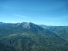
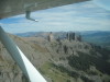
| Canyon Wall with airplane shadow. | Climbing in the ridge lift for Schofield Pass. | Schofield Pass, looking S to Crested Butte ski mountain. | West of Schofield Pass, looking SW. | Rock Spires above Gunnison, Colorado. sequence 1 | ||
| ||||||
|
|
|
|
|
||
| ||||||
| Rock Spires above Gunnison, Colorado. sequence 2 | Rock Spires above Gunnison, Colorado. sequence 3 | Rock Spires above Gunnison, Colorado. sequence 4 | Rock Spires above Gunnison, Colorado. sequence 5 | Rock Spires above Gunnison, Colorado. sequence 6 | ||
| ||||||
|
|
|
|
|
||
| ||||||
| Rock Spires above Gunnison, Colorado. sequence 7 | Rock Spires above Gunnison, Colorado. sequence 8 | Rock Spires above Gunnison, Colorado. sequence 9 | Kebler Pass, looking NW. | Crested Butte Ski Area. | ||
| ||||||
|
|
|
|

|
||
| ||||||
| Mountain community near Crested Butte. | Looking NE over Conundrum Hot Springs above Aspen. | Looking down on Conundrum Hot Springs above Aspen. 1 | Looking down on Conundrum Hot Springs above Aspen. 2 | Looking NW at RWY 33, Aspen Airport (ASE), Colorado. | ||
| ||||||
|
|
|
|

|
||
| ||||||
| Aspen, top of Ajax Mountain | Aspen, E face of Ajax Mountain. There are hang gliders and flying parachutes down the valley toward the bottom of the picture. | Closeup of hang gliders and flying parachutes. | Aspen, base of Ajax Mountain Ski Area ends in town. ASE airport above. | Ruedi Reservoir, looking W. | ||
| ||||||
|
|

|
|
|
||
| ||||||
| Ruedi Reservoir, N of Aspen, looking W. | Mountain houses above Beaver Creek Ski Area, N of I-70. | Colorado River, looking W from Kremmling, Colorado. 1 | Colorado River, looking W from Kremmling, Colorado. 2 | Wind Sock on hill, on short final to RWY 27, Kremmling Airport (20V), Colorado. | ||
| ||||||
|

|

|
|
|
||
| ||||||
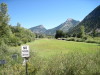
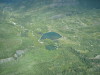
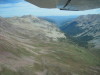
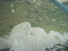
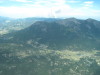
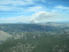
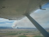
| Looking E from Lake Granby to Long's Peak. | Meadow E of Grand Lake, continental divide on the horizon. | Mountain lakes on the W side of Rocky Mountain National Park (RMNP). | Long's Peak, looking E. Sprague Pass is over the ridge to the left. | Fire! Over Estes Park, looking E to smoke/fire W of Loveland, Colorado, 09/12/10. | ||
| ||||||
|

|
|
|
|
||
| ||||||
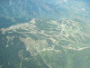
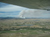
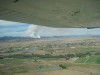
| Loveland Reservoir Road fire, looking NE. 09/12/10. 1 | Loveland Reservoir Road fire, looking NE. 09/12/10. 2 | Loveland Reservoir Road fire, looking NW. 09/12/10. 1 | Loveland Reservoir Road fire, looking NW. 09/12/10. 2 | Loveland Reservoir Road fire, looking NW. 09/12/10. 3 | ||
| |||
|
|
||
| |||
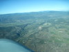
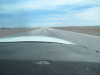
| Loveland Reservoir Road fire, looking W. 09/12/10. | N9513G, home again, landing RWY 15, Fort Collins - Loveland Airport (FNL), Colorado. | ||