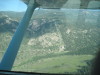
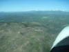
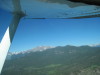
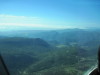
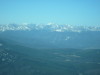
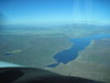
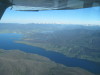
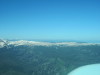
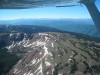
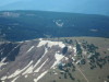
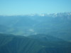
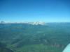
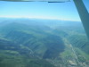
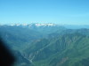
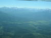
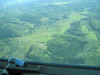
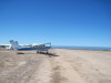
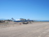
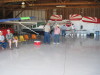
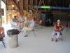
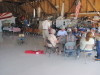
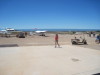
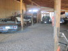
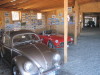
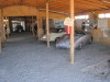
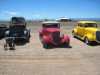
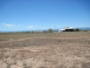
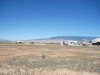
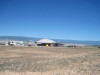
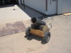
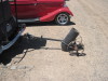
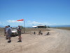
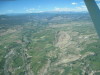
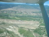
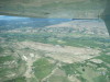
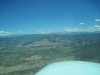
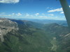
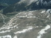
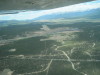
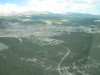
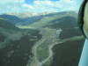
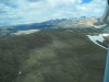
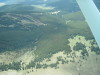
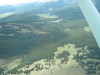
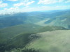
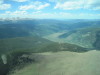
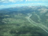
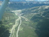
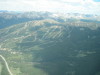
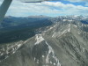
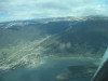
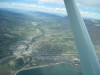
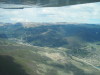
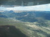
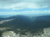
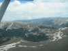
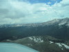
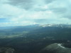
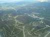
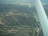
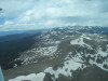
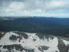
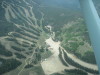
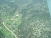
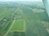
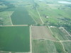
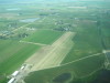
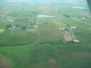
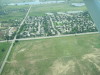
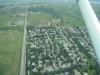
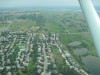
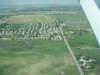
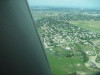
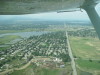
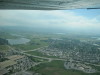
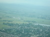
Sky Island Ranch Airport (3CO0): Father's Day Flyin, 06/20/10. Click on a picture to enlarge.

 
  img-0529 img-0530 img-0531 img-0532 img-0533  
 
  Big Thompson Project, electric generating station above Pinewood Res. Elk Park Airport (in meadow) looking SW from US36. Long's Peak and Mt Lady Washington left, Twin Sisters right. Coffintop Res (blue in center) west of Lyons, CO. Elk Park Airport, looking W, 06/20/10.

 
  img-0534 img-0535 img-0536 img-0537 img-0538  
 
  Elk Park Airport, looking S, 06/20/10. Elk Park Airport, looking E, 06/20/10. Long's Peak, looking W, 06/20/10. Looking W across the Continental Divide, S of Long's Peak, 06/20/10. 1 Looking W across the Continental Divide, S of Long's Peak, 06/20/10. 2

 
  img-0540 img-0541 img-0544 img-0546 img-0547  
 
  Crossing the Continental Divide, looking SE from Buchanan Pass. Still climbing, crossing the Continental Divide, at Buchanan Pass. Winter Park Ski Area, looking SW from Buchanan Pass, 06/20/10. Lake Granby, looking NW from Buchanan Pass, 06/20/10. Lake Granby, looking NW to Shadow Mountain Res, 06/20/10.

 
  img-0550 img-0551 img-0552 img-0555 img-0557  
 
  Over Fraiser, CO, looking SW, Mt Sopris at the far left horizon. Green Mountain Res is full, looking N between Dillon and Kremmling, CO. SW bound, over the Gore Range, looking toward Vail and Beaver Creek, Mountains W of Aspen on the horizon. Vail Ski Area, looking S. Avon, CO and Beaver Creek Ski Area, 06/20/10. Note Walmart store center left, at the east end of what used to be the Avon Airport.

 
  img-0558 img-0559 img-0561 img-0562 img-0563  
 
  Red Table VOR and weather radar. Note "green" VOR and "white" radar dome. 1 Red Table VOR and weather radar. Note "green" VOR and "white" radar dome. 2 Aspen Airport from Red Table VOR, looking S, fuzzy. Mount Sopris, looking SW from Red Table VOR. Basalt, looking SE up the Roaring Fork River toward Aspen.

 
  img-0564 img-0565 img-0568 img-0569 img-0570  
 
  Looking S from Carbondale toward McClure Pass (right center), Mt Gunnison on the Horizon. West side of McClure Pass, looking SE. Airport W of McClure Pass. Flying "W"? Looking SE. Pond is at the east end of the airstrip. On the ground at the Father's Day Flyin at Sky Island Airport, Delta, CO. 1 On the ground at the Father's Day Flyin at Sky Island Airport, Delta, CO. 2

 
  img-0571 img-0572 img-0573 img-0574 img-0575  
 
  Sky Island hangar with food. Sky Island hangar cooler (black box). Sky Island hangar socializing. Sky Island ramp. Toys. 1

 
  img-0576 img-0577 img-0578 img-0579 img-0580  
 
  Toys. 2 Toys. 3 Toys on the ramp. Note cannon trailer. Camping at Sky Island. Looking NW to the ramp and hangar.

 
  img-0581 img-0582 img-0583 img-0584 img-0588  
 
  Looking NNW to the ramp and hangar. Canon... shoots bowling balls. 1 Canon... shoots bowling balls. 2 Canon... firing line. Paonia Airport, CO - North Fork Valley (7V2), looking down RWY 5.

 
  img-0589 img-0590 img-0591 img-0592 img-0595  
 
  Paonia Airport, CO - North Fork Valley (7V2), looking NW. Paonia Airport, CO - North Fork Valley (7V2), looking WNW. From Paonia Airport, looking NE toward the Ragged Mountains that are W of Marble, CO. Looking NE to Maroon Bells, Aspen. Mt Crested Butte Ski Area, looking S toward Crested Butte.

 
  img-0596 img-0597 img-0598 img-0599 img-0600  
 
  Conundrum Hot Springs above Aspen, looking NNE. Castle Peak above Conundrum Hot Aprings, looking NNE. Looking N, Aspen Airport isin the tiny open area center right. Looking S to Independence Pass, SW of Aspen, CO, 06/20/10. Looking S to Leadville - Lake County Airport (LXV), RWY 16, 06/20/10.

 
  img-0601 img-0602 img-0603 img-0604 img-0605  
 
  Looking SE toward Leadville, CO, 06/20/10. Looking NE from Leadville toward Fremont Pass, 06/20/10. Fremont Pass is to the right of the mine tailings. Looking W to Ski Cooper, at the top of Tennessee Pass N of Leadville, CO, 06/20/10. 1 Looking W to Ski Cooper, at the top of Tennessee Pass N of Leadville, CO, 06/20/10. 2

 
  img-0606 img-0607 img-0608 img-0609 img-0610  
 
  Looking NW to the 10th Mountain Division camp. 1 Looking NW to the 10th Mountain Division camp. 2 Vail Pass, looking NE from Copper Mountain Ski Area, 06/20/10. Looking S to Cooper Mountain Ski Area. 1 Looking S to Cooper Mountain Ski Area. 2

 
  img-0613 img-0614 img-0615 img-0616 img-0617  
 
  Peak 1 SW of Breckenridge does not have the US flag on it today. 06/20/10. Dillon Res, looking E up I-70 to the Eisenhower Tunnel, 06/20/10. Dillon Res, looking N down the Blue River toward Green Mountain Res and Kremmling, CO. Keystone Ski Area. Looking SE from Dillon. 1 Keystone Ski Area. Looking SE from Dillon. 2

 
  img-0618 img-0619 img-0620 img-0621 img-0622  
 
  Looking N from I-70. The mine tailing are abeam Buffalo Pass, which would be on the left. Looking E to Corona Pass at the far horizon. 1 Looking E to Corona Pass at the far horizon. 2 Looking NNE from Winter Park to Long's Peak. Winter Park Ski Area. 1

 
  img-0623 img-0624 img-0625 img-0626 img-0627  
 
  Winter Park Ski Area. 2 Top of Corona Pass, looking N, 06/20/10. Top of Corona Pass, looking W toward Winter Park Ski Area, 06/20/10. Lake Eldora Ski Area, looking NW. Checkout the dome house, center left.

 
  img-0628 img-0629 img-0630 img-0631 img-0632  
 
  Colorado Antique Airport, looking E. Colorado Antique Airport, looking W. Skylane Airport is abeam the close edge of the water. East is right. Skylane Airport, looking W, near Berthoud, CO. Loveland housing development. Looking W.

 
  img-0633 img-0634 img-0635 img-0636 img-0637  
 
  Loveland housing development. Looking S. 1 Loveland housing development. Looking S. 2 Loveland housing development. Looking E. Loveland housing development. Looking NE Loveland housing development. Looking N.

 
  img-0638 img-0639  
 
  Loveland HP plant, looking NW. 1 Loveland HP plant, looking NW. 2

created with igal