 | ||||||
|
|
|
|
|
||
| ||||||
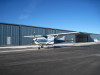
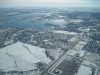
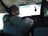
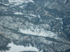
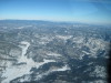
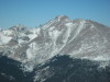
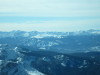
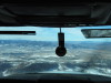
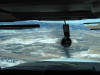
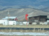
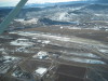
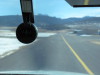
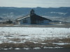
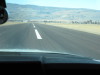
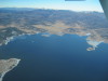
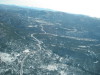
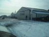
| It was a cold, crisp morning, 10 deg F. Preflighted and ready to go. | Loveland, Colorado, Horseshoe Reservoir, looking SE. | Fort Collins, Colorado, looking north up Taft Hill Road. | Loveland, Colorado, looking south. Pike's Peak ~100 miles south. | Just completed cruise checklist, flight plan open. | ||
| ||||||
|
|
|
|
|
||
| ||||||
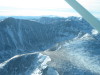
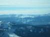
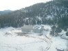
| Elk Park International Airport. Looking W. | Elk Park International Airport is in the small meadow, center low. | Elk Park across Estes Park to the Mummy Range. | Looking N to Elk Park International Airport. | Looking N across Elk Park to Elk Mountain, Wyoming. | ||
| ||||||
|
|
|
|
|
||
| ||||||
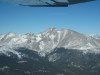
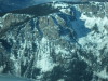
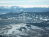
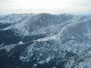
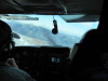
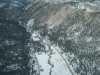
| Buchanan Pass at Sawtooth Mountain, crossing the Continental Divide westbound south of Long's Peak, Colorado. | Twin Sisters Peaks, Elk Park on right, Estes Park to the Mummy Range. | Long's Peak, Mt Lady Washington on right, looking NW. | Long's Peak, Mt Lady Washington on right, looking NW. 2 | Approach to Buchanan Pass, looking SW. Pass not in picture. | ||
| ||||||
|
|
|
|
|
||
| ||||||
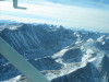
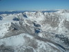
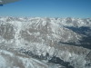
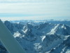
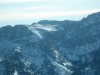
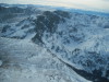
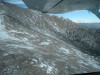
| Over Buchanan Pass, looking NW to Cameron Pass, Rawahs to the right, Mt Zirkel Wilderness at far horizon. | About to cross the Continental Divide, S of Longs Peak, looking NW. | Over Buchanan Pass, westbound, looking S to Mt Evans. | Looking SSW from Buchanan Pass, Grays and Toreys Peaks (twin peaks) left of center. | Grays and Toreys Peaks at center. | ||
| ||||||
|
|
|
|
|
||
| ||||||
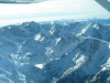
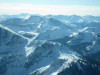
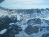
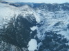
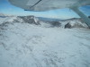
| Winter Park Ski Area, Colorado, looking SSW. | Winter Park Ski Area, Colorado, looking SSW. 2 | Looking down into the rocks and trees W of the Continental Divide. | Looking SE back toward the Continental Divide and the Indian Peaks Wilderness. | Looking E toward Sawtooth Mountain and Buchanan Pass. | ||
| ||||||
|
|
|
|
|
||
| ||||||
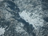
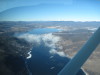
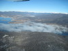
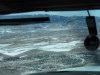
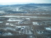
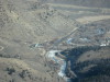
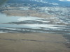
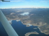
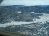
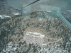
| Looking NNE toward Long's Peak from W of the Continental Divide. | Arapaho Bay, E end of Lake Granby, looking WNW. | Arapaho Bay and Lake Granby are open water. Shadow Mountain Reservoir is frozen. This is near the headwaters of the Colorado River. | Granby, Colorado, 8203 MSL, looking down the Colorado River (on right). | Granby, Colorado, 8203 MSL, looking down the Colorado River (on right). 2 | ||
| ||||||
|
|
|
|
|
||
| ||||||
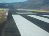
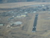
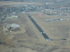
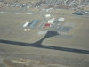
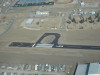
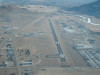
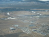
| Granby Airport (GNB), Colorado, looking SW. | Granby Airport (GNB), midfield, left downwind, landing RWY 9. | Granby has a new taxiway and resurfaced runway. | Granby Airport (GNB), new "D" turnout at the west end. | GNB, left base, landing RWY 9. | ||
| ||||||
|
|
|
|
|
||
| ||||||
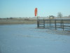
| GNB, left base, turning final, landing RWY 9. | Wind sock and horses at Granby. | GNB, turning onto RWY 27, planning right, closed traffic. | GNB, shadow, no sun-dog. | Granby, Sol Vista Ski Area to Winter Park Ski Area, Colorado. | ||
| ||||||
|
|
|
|
|
||
| ||||||
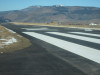
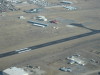
| Granby Airport (GNB), Colorado, midfield, right downwind for RWY 27. | GNB, abeam RWY 27 for landing. | GNB, key point RWY 27. | GNB, key point RWY 27. 2 | GNB, right base RWY 27. | ||
| ||||||
|
|
|
|
|
||
| ||||||
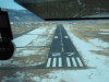
| GNB, right base, turning final RWY 27. | GNB, final RWY 27. | GNB, final RWY 27. 2 | GNB, final RWY 27. | GNB, roundout RWY 27. | ||
| ||||||
|
|
|
|
|
||
| ||||||
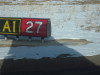
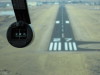
| GNB, touchdown RWY 27. | GNB, rollout RWY 27. | GNB, off the runway, taxiing E for departure RWY 27. | GNB, Sol Vista terminal building. | GNB, sign means "on taxiway A1, at RWY 27. | ||
| ||||||
|
|
|
|
|
||
| ||||||
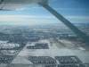
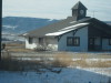
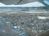
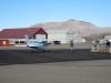
| GNB, taxiing onto RWY 27 for departure to Kremmling (20V). | GNB, Sol Vista terminal building. 2 | Granby, Colorado, looking SSW. | Railroad tracks, Hot Sulphur Springs Pool and Spa, looking NW. | Railroad tracks, Hot Sulphur Springs Pool and Spa, looking NW. 2 | ||
| ||||||
|
|
|
|
|
||
| ||||||
| Hot Sulphur Springs Pool and Spa. | Hot Sulphur Springs Pool and Spa. 2 | Hot Sulphur Springs Pool and Spa. 3 | Hot Sulphur Springs Pool and Spa. 4 | Hot Sulphur Springs Pool and Spa. 5 | ||
| ||||||
|
|
|
|
|
||
| ||||||
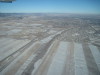
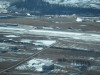
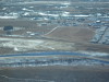
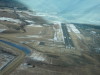
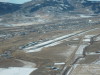
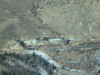
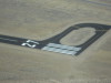
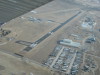
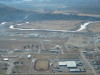
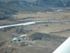
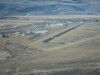
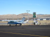
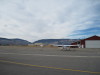
| fuzzy Kremmling. | Kremmling Airport (20V), Colorado, 7411 MSL, RWY 27, looking WNW. | Kremmling Airport (20V), Colorado, RWY 27, runup area. Note new pavement and markings. | Kremmling Airport (20V), note concrete pad near wind sock. A G5 visits regularly. | Kremmling Airport (20V), Colorado, RWY 9, runup area. Note new pavement and markings. | ||
| ||||||
|
|
|
|
|
||
| ||||||
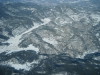
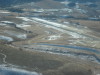
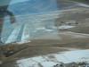
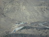
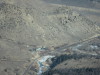
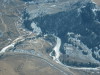
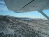
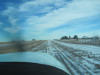
| Kremmling Airport (20V), note wind circle. Right traffic RWY 27, left traffic RWY 9. | Kremmling, turning right crosswind RWY 27. | Kremmling, looking E, up the Colorado River. | Kremmling, right downwind RWY 27. Blue River (top right), meeting the Colorado River (close). | Kremmling, Blue River joining the Colorado River (right). | ||
| ||||||
|
|
|
|
|
||
| ||||||
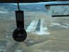
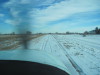
| Kremmling wind sock on knoll. | Kremmling, right base RWY 27. | Kremmling, wind sock on knoll. 2 | Kremmling, right base RWY 27. 2 | Kremmling, final RWY 27. | ||
| ||||||
|
|
|
|
|
||
| ||||||
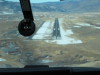
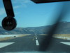
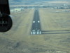
| Kremmling, final RWY 27. 2 | Kremmling, final RWY 27. 3 | Kremmling, rollout RWY 27. | Kremmling, rollout RWY 27. 2 | Kremmling, rollout RWY 27. 3 | ||
| ||||||
|
|
|
|
|
||
| ||||||
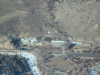
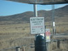
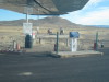
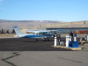
| Kremmling Airport (20V), Colorado, fuel prices 12/05/09. | Kremmling self service fuel bay. | Kremmling self service fuel bay. 2 | Kremmling, setting up for fueling. | Kremmling, setting up for fueling. 2 | ||
| ||||||
|
|
|
|
|
||
| ||||||
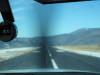
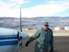
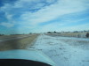
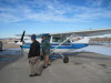
| Intrepid aviator. :-) | Kremmling, Beech 18 on the ramp. | Kremmling, C206 tied down. | Kremmling, looking W toward Colorado River canyon. | Departing Kremmling RWY 27. This mountain is immediately south of the airport. | ||
| ||||||
|
|
|
|
|
||
| ||||||
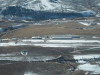
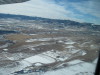
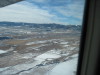
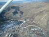
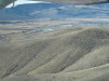
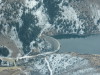
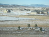
| W of Kremmling, looking SE, Williams Fork Reservoir. | Williams Fork Reservoir, looking SE. | Williams Fork Reservoir, looking S at eggshell dam. | Property on Colorado River near Parshall, Colorado. | Over Lake Granby, looking across Shadow Mountain Reservoir toward Grand Lake to the headwaters of the Colorado River. | ||
| ||||||
|
|
|
|
|
||
| ||||||
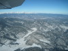
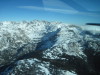
| Marinas on the W side of Lake Granby. US 34, looking NW toward Willow Creek Pass. | Sprague Pass, looking E across the Continental Divide. | Sprague Pass, looking E across the Continental Divide. 2 | Sprague Pass, looking NNE across the Continental Divide. | Crossing the Continental Divide, looking SSE across the Indian Peaks Wilderness. | ||
| ||||||
|
|
|
|
|
||
| ||||||
| East of the Continental Divide, looking SE, just south of Long's Peak. | Twin Sisters, looking E. | East slope of Long's Peak, looking N | Peak-to-Peak Highway, US 36, looking S, near Long's Peak. | Elk Park International Airport, looking E. | ||
| ||||||
|
|
|
|
|
||
| ||||||
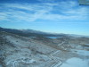
| Elk Park International Airport, looking NE. | Elk Park International Airport, looking E. 2 | Elk Park International Airport, hangar, looking SSW. | Cabins E (downstream) from Elk Park International Airport. | Granite mine cut into the mountain, E of US 7, E of Elk Park. | ||
| ||||||
|
|
|
|

|
||
| ||||||
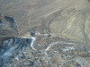
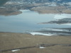
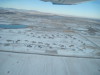
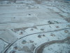
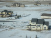
| Carter Lake, West of Loveland, Colorado, looking NW. | Carter Lake, West of Loveland, Colorado, looking NW. 2 | West of Loveland, looking N, Lazy W airport is 1 mi E. | Lazy W Airport, 5200 MSL, W of Loveland, looking N. Note 2 parallel runways and one diagonal runway. | Lazy W Airport, looking S. | ||
| ||||||
|
|
|
|
|
||
| ||||||
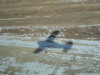
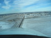
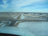
| Lazy W Airport, final, landing E. | Lazy W Airport, final, landing E. 2 | Lazy W Airport, final, landing E. 3 | Lazy W Airport, final, landing E. 4 | Lazy W Airport, rollout, E. | ||
| ||||||
|
|
|
|
|
||
| ||||||
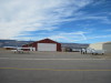
| Lazy W Airport, hangar and Mike. | Lazy W Airport, on the ramp. | Lazy W Airport, wind sock, looking NE. | Lazy W Airport, departing W, looking NW. | Lazy W Airport, departing W, looking NW. 2 | ||
| ||
|
||
| ||
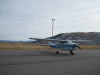
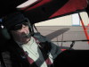
| Bob M in Redbird, 12/05/09... taildragger current after 6 years! | ||