 | ||||||
|
|
|
|
|
||
| ||||||
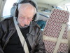
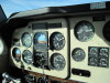
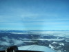
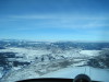
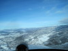
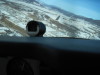
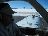
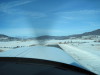
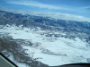
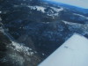
| Sometimes the GPS is fun, sometimes takes concentration! 11/24/09. | John M is happy to fly! | Horsetooth Reservoir is not full 11/25/09. | Climbing on course. | West of Cameron pass, looking W over North Park, Rabbit Ears rock at center, left. | ||
| ||||||
|
|
|
|
|
||
| ||||||
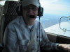
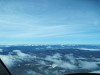
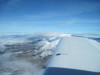
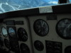
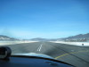
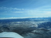
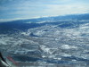
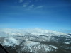
| North Park, looking NW over the Mt Zirkel Wilderness. | Over Cameron Pass, looking N over the Rawah Wilderness. | North Park, looking NW toward Walden, Colorado. | CO-14 meets US-40 at Muddy Pass, Rabbit Ears Pass and pinnacle in center. | Roomy airplane... it is a Bonanza! | ||
| ||||||
|
|
|
|
|
||
| ||||||
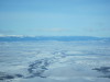
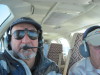
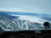
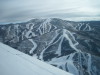
| Smooth flight in the back seat, Larry E checking the view. | North Park, looking NW across the Zirkel Wilderness. | Clouds over Willow Creek Pass to Granby, Colorado. | Steamboat Ski Area, 11/25/09, #1 | Steamboat Ski Area, tree cut is Storm Peak lift line, 11/25/09, #2 | ||
| ||||||
|
|
|
|
|
||
| ||||||
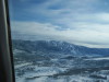
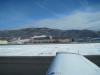
| Descending into Steamboat Springs. | Steamboat Springs from over the ski area, looking NW to the airport, low left. | Steamboat Ski Area, top of Christy lift, Thunderhead (gondola), Storm Peak, 11/25/09, #3 | Steamboat Ski Area, from left downwind RWY-32, Steamboat, 11/25/09, #4 | Steamboat Springs, Colorado, from the airport, looking ENE to downtown. | ||
| ||||||
|
|
|
|
|
||
| ||||||
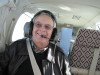
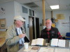
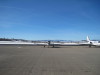
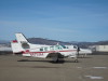
| Left base, turning final, KSBS. | Landed 32, before the first turnoff. Well done! | KSBS terminal building. | KSBS FBO, John M and Don H discussing operations. | Bonanza N4759M at KSBS, looking NW from the FBO. | ||
| ||||||
|
|
|
|
|
||
| ||||||
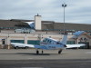
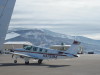
| When I grow up, I wanna be a jet! | Bonanza N4759M, looking E toward FBO. | Bonanza N4759M, KSBS ramp looking NW to the ski area. | Takeoff roll... | Departing KSBS RWY-32 (4,400 feet long).. | ||
| ||||||
|
|
|
|
|
||
| ||||||
| Accelerating. | Yes-sir-ee, captain, its gusty! | Airborne! | Climbing runway heading (320 deg) for the Elk river for departure turn. | First turn after departure. | ||
| ||||||
|
|
|
|
|
||
| ||||||
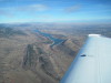
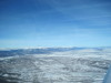
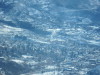
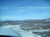
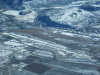
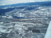
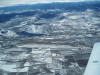
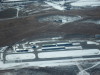
| The Elk River meets the Yampa River. | Looking NE across KSBS airport. | Looking SE across Sol Vista Ski Area toward Corona Pass, winter park ski area on right. | Granby, Colorado, and new airport improvements, 11/25/09. | Granby Airport (KGNB), Colorado, looking SE. Note new taxiway on S side all the way to the E end. | ||
| ||||||
|
|
|
|
|
||
| ||||||
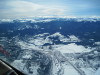
| Looking S across Granby and Sol Vista Ski Area toward Corona Pass, winter park ski area upper left. | Looking W to Granby Airport (KGNB), town of Granby. | Granby Airport (KGNB), E end, new taxiway and hangars. | Looking S across Fraiser, Colorado to Winter Park Ski area and Berthoud Pass. Corona Pass and James Peak on the left edge. | East of Corona Pass, looking SE. | ||
| ||
|
||
| ||
| East of Corona Pass, looking NW to the Indian Peaks wilderness Area, toward Long's Peak. | ||