 | ||||||
|

|
|
|
|
||
| ||||||
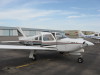
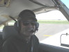
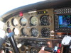
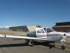
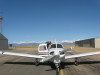
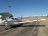
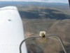
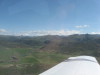
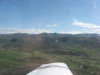
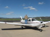
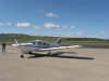
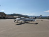
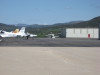
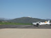
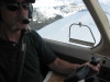
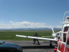
| Preflight check: lights. | Switch is "on". | N47415 on the ramp, FNL, looking toward the mountains #1. | N47415 on the ramp, FNL, looking toward the mountains #2. | "Clear prop"! | ||
| ||||||
|
|
|
|
|
||
| ||||||
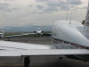
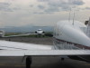
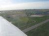
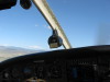
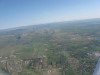
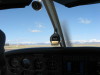
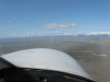
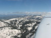
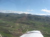
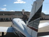
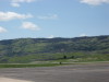
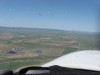
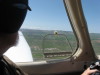
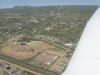
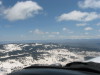
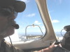
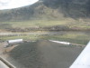
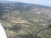
| FNL, taxiing to "33". | So long "FNL"... we left the jet on the ramp. | Climbing out, manifold pressure set to 35". | Turning to heading 340 please. | Gaining altitude, looking north... Look! Chrisman Field Airport, RWY 34... an easy out! | ||
| ||||||
|
|
|
|
|
||
| ||||||
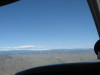
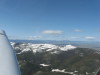
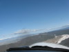
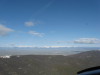
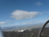
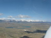
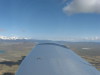
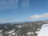
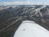
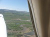
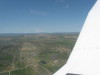
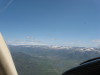
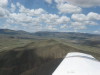
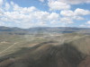
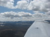
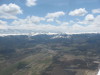
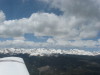
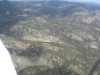
| Up and up and away. Must be windy... look at the clouds. | Where is the Crystal Lakes Airport? Straight ahead... valley floor, before the water. | Turning to the northwest toward Ute Pass. | North Park and Walden in the distance. | Here is a safe haven in the elk meadow just in case... Ute pass on the left. | ||
| ||||||
|
|
|
|
|
||
| ||||||
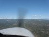
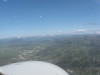
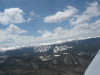
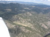
| Take a 45 degree cut at the pass. | And finally we are ready to commit to cross the pass. | Welcome to Walden Airport, Colorado (33V). The sun is shining! | A bit chilly.. coats, anyone? | One pass down, having FUN! | ||
| ||||||
|
|
|
|
|
||
| ||||||
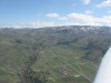
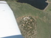
| Ready for takeoff at Walden. | Simulated engine failure, (Sim EOE) was not successful... went around... next time! | Line up on Buffalo Pass... see straight cut in the trees (power line) with snow on it. | Looking at the spectacular Zirkels. Wow, the view is fantastic... gonna go camping up there. | Lake John & friends. Great navigation point. | ||
| ||||||
|
|
|
|
|
||
| ||||||
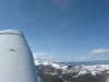
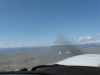
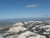
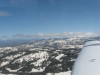
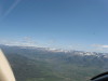
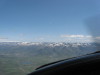
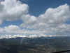
| The Zirkels are still holding a lot of snow. | Can you see Rabbit Ears at the left edge? | Down valley toward Muddy Pass (US40 and CO14) toward Kremmling. | Power line cut dead ahead! What?!? low clouds?!? | Heading south for Rabbit Ears instead of Buffalo Pass. | ||
| ||||||
|
|
|
|
|
||
| ||||||
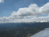
| Cruising above Rabbit Ears Pass. | Yampa Valley in the distance. | Looking north, yup, cloud base is at 12,500 MSL. | Hahns Peak (north of Steamboat) in the distance. | The Gondola House. Hey! When did they build Thunderhead lodge? | ||
| ||||||
|
|
|
|

|
||
| ||||||
| Sleeping Giant without a snow blanket. | Looking north up Fish Creek valley toward Buffalo Pass (on the right), and Strawberry Park Hot Springs (on the left). | Flying around Deer Mountain for the approach into Steamboat. | Turning downwind for RWY 32 at Steamboat Springs Airport, Colorado (SBS). | Continuing downwind #2. | ||
| ||||||
|
|
|
|
|
||
| ||||||
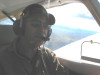
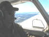
| Continuing downwind #3. | Houston, Jim has safely landed the Arrow Steamboat! | Panorama around Steamboat #1. | Panorama around Steamboat #2. | Panorama around Steamboat #3. | ||
| ||||||
|
|
|
|
|
||
| ||||||
| No mountain instruction???? This is what is left of a Cirrus that landed hot and long. Take some mountain flying instruction! | Panorama around Steamboat #4. | Panorama around Steamboat #5. | Hayden Airport, Colorado (KHDN) and the Hayden the power plant. | Craig - Moffat County Airport, Colorado (KCAG). | ||
| ||||||
|
|
|
|
|
||
| ||||||
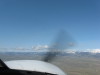
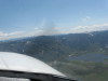
| Upwind at Craig, "shopping" the airport before landing. Hey! There is a truck on the runway... no landing for us. | Yes, there are horses and a rodeo grounds at Craig. | Turning left crosswind at Craig. | Headed east, south of Steamboat, ski area (Top of Mount Werner), then left to the Zirkels. | Clouds still hanging around... going for Rabbit Ears Pass, then Kremmling. | ||
| ||||||
|
|
|
|
|
||
| ||||||
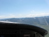
| Yup, just a little more right to Rabbit Ears Pass. | US 40 eastbound up to Rabbit Ears Pass. | Lake Catamount at the west base of Rabbit Ears Pass. | Yes, there are the Rabbit Ears! | Descending toward Kremmling, ignoring the turbulence. | ||
| ||||||
|
|
|
|
|
||
| ||||||
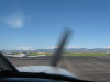
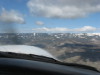
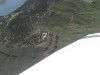
| There is an airstrip on the other side of that hill! | Kremmling Airport, Colorado (20V) in sight... right traffic, terrain in the pattern. Piece-O-Cake! | Wind sock on small hill while on short final to RWY 27 Kremmling. | Yes, it was a proper downwind take off from Kremmling. Take mountain instruction to understand why. | Continental Divide, looking southeast. Corona Pass is the broad bench to the left. Winter Park Ski Area below treeline. | ||
| ||||||
|
|
|
|
|
||
| ||||||
| Winter Park Ski Area. | Looking for the updraft, lets get closer to the terrain! | Across the Continental Divide, headed north. "Indian Peaks" wilderness of the left wingtip. | Longs Peak is the high terrain... flying the "Peak to Peak" highway north toward Twin Sisters Peaks. | Ah, it was a great day to fly in the mountains... continuing north to FNL. | ||
| ||||||
|
|
|
|
|
||
| ||||||
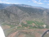
| Elk Park International Airport! Looking north, take off east (downhill) at that strip! | This is where to have fun in the mountains... proficiency... competency. | Note the large hangar at the southwest corner of the strip. | A little house in the foot hills... west of Loveland, Colorado. | Yow! Watch that first step off the back deck! | ||
| |||||
|
|
|
|
||
| |||||
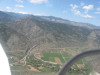
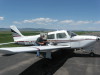
| Ditch crosses US34, looking west toward Estes Park, Colorado... note the siphon pipe just above the road. | Palisade Mountain is above the "Narrows", going up US34 thru the Big Thompson Canyon, west of Loveland. | Home again at FNL after a day of safe mountain flying and new experience! | Fill her up for the trip to Kansas. I'll be back for more training and adventure! Thanks, Jer/! | ||