 | ||||||
|
|
|
|
|
||
| ||||||
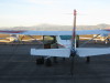
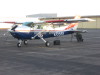
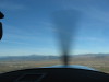
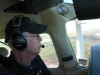
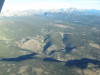
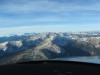
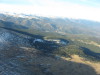
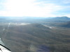
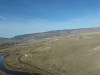
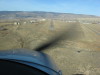
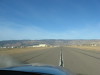
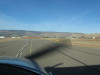
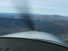
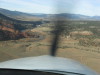
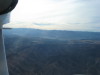
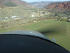
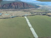
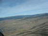
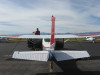
| CAP C-182 N9559X at the beginning of the day. On the FNL ramp with Long's Peak, 14,255' MSL over the left wing. | Preflight, untying the airplane. | FNL, out of the pattern, westbound. Long's Peak, 14,255' MSL at left, center. | CAP mountain mission pilot concentrating on navigating into the mountains. | |||
| ||||||
|
|
|
|
|
||
| ||||||
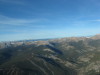
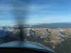
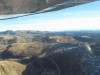
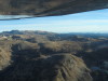
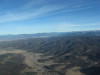
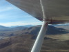
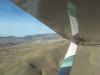
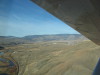
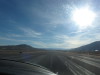
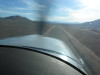
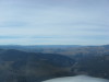
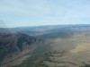
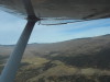
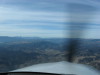
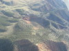
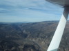
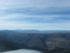
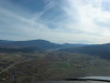
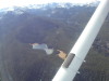
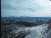
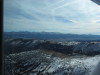
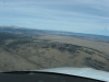
| Corona Pass, looking W from the E side of the Continental divide. Note "sun dog" bottom right. | Looking SW to James Peak from E of Corona Pass. | Corona Pass, looking W. The far horizon is the Gore Range near Dillon, CO. | ||||
| ||||||
|
|
|
|
|
||
| ||||||
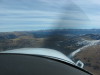
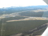
| Approaching Corona Pass E to W. | Looking N from Corona Pass. | Across Corona pass. note Winter Park Ski Area in mid-frame. | Looking N from the W side of Corona Pass. The road is the old railroad bed over Rollings Pass. 1 | Looking N from the W side of Corona Pass. The road is the old railroad bed over Rollings Pass. 2 | ||
| ||||||
|
|
|
|
|
||
| ||||||
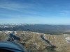
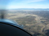
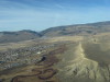
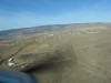
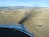
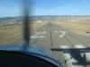
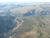
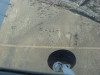
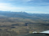
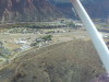
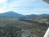
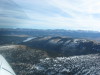
| W of Corona Pass, looking NNW toward Tabernash at the base of the next ridge. Granby and Grand Lake are beyond the first ridge. | Hot Sulphur Springs, looking W. | Kremmling, looking W to the Colorado River gorge. | Kremmling, McElroy Airport (20V), looking S RWY 9/27. Ramp in mid-lower of frame. | |||
| ||||||
|
|
|
|
|
||
| ||||||
| ||||||
|
|
|
|
|
||
| ||||||
| ||||||
|
|
|
|
|
||
| ||||||
| ||||||
|
|
|
|
|
||
| ||||||
| ||||||
|
|
|
|
|
||
| ||||||
| ||||||
|
|
|
|
|
||
| ||||||
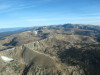
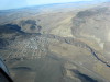
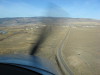
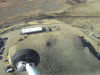
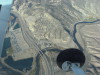
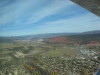
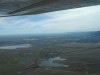
| Dotsero, looking NE: Impact crater or cinder cone? Note mining operation and road on NE wall of the crater. Note that there is a way for water to flow into the crater, but no erosion-cut for outflow. | ||||||
| ||||||
|
|
|
|
|
||
| ||||||
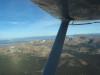
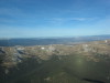
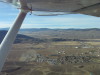
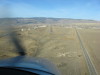
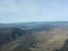
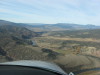
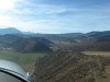
| Dotsero, looking W (I-70), confluence of Colorado River and Eagle River. | Dotsero, looking W down Glenwood Canyon toward Grand Mesa. | Dotsero, looking SW to Mount Sopris at Carbondale. | Cottonwood Pass SW of Eagle and Dotsero, looking SW toward Mount Sporis, Mount Lambourn in the background. | Glenwood Springs Airport (GWS), Colorado, looking E at mid field, RWY 16/34. | ||
| ||||||
|
|
|
|
|
||
| ||||||
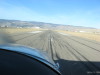
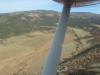
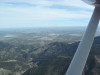
| GWS left downwind RWY 34. | GWS final RWY 34. | Off GWS, past Carbondale, enroute El Jebel/Basalt, then Aspen. | Carbondale looking S to Mount Sporis, Crystal River on the right, toward Marble. | Carbondale looking NNW toward Glenwood Springs. | ||
| ||||||
|
|
|
|
|
||
| ||||||
| Looking E to Carbondale. White is ice from the sprinklers. | ||||||
| ||||||
|
|
|

|
|
||
| ||||||
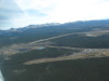
| Looking SE, Leadville Airport (LXV) is the cut thru the trees. 1 | Looking SE, Leadville Airport (LXV) is the cut thru the trees. 2 | CAP N9559X on the ramp at LXV. Mount Massive, 14,421' MSL above the right wing. | ||||
| |||||
|
|
|
|
||
| |||||
| Home again, home again, fueling N9559X at FNL. | |||||