 | ||||||
|
|
|
|
|
||
| ||||||
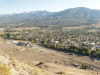
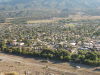
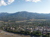
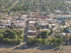
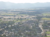
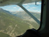
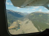
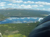
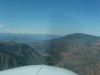
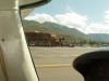
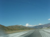
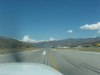
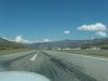
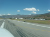
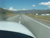
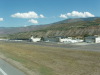
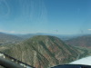
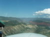
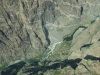
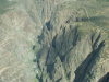
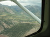
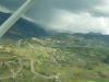
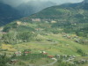
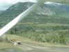
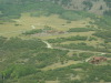
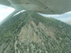
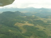
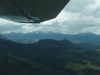
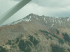
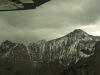
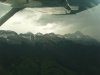
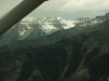
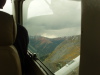
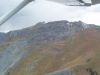
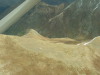
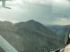
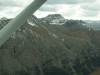
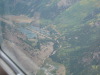
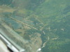
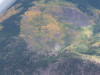
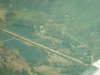
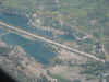
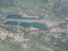
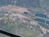
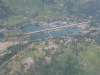
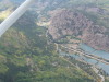
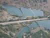
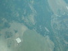
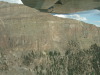
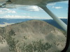
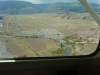
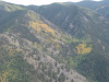
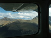
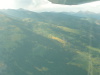
| Salida "S" mountain, looking E-SE toward town. | Salida "S" mountain, looking SE toward town. | Salida "S" mountain, looking S-SE toward town. | Salida "S" mountain, looking S toward downtown. | Salida "S" mountain, looking SW toward airport. | ||
| ||||||
|
|
|
|
|
||
| ||||||
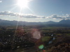
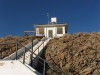
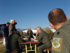
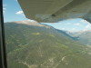
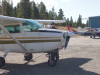
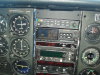
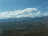
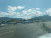
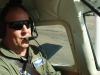
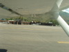
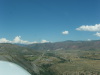
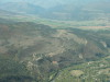
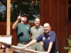
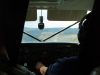
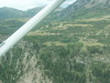
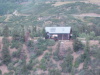
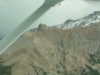
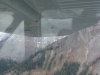
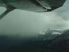
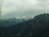
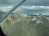
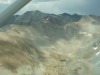
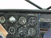
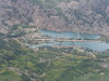
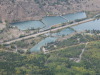
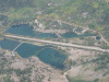
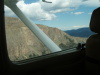
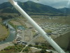
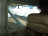
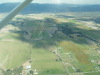
| Salida "S" mountain, sun glare, looking W toward airport. | Salida "S" mountain, looking W toward airport (left) and stack (right).. | Salida "S" mountain, looking W-NW Mount Antero. | Salida "S" mountain, mountain top house. | Harriett Alexander Airport (ANK), Salida, CO, preflight safety briefing. | ||
| ||||||
|
|

|
|
|
||
| ||||||
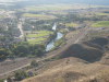
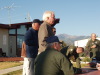
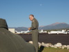
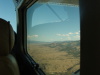
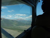
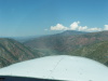
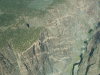
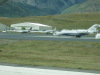
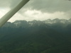
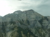
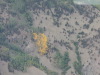
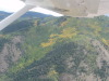
| ANK, safety focus. | ANK, John Mitchell giving safety briefing. | South of ANK, northbound, looking East. | Power line cut below timberline, above Granite, CO. | 14er above Granite, CO. | ||
| ||||||
|
|
|

|
|
||
| ||||||
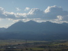
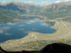
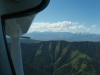
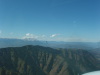
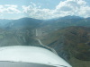
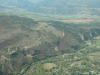
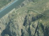
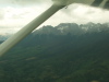
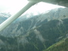
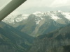
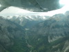
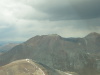
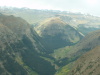
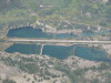
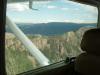
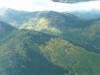
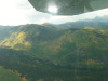
| At Granite, CO, looking N toward Leadville, CO | At Granite, CO, looking NW toward Mount Elbert, then right to Mount Massive. | At Granite, CO, looking W toward the top of the valley. Pass is at the top of the valley, then left. | High clouds over mountain valley. | Twin lakes, CO, looking W toward Independence Pass. We do not fly Independence Pass. | ||
| ||||||
|
|
|
|
|
||
| ||||||
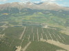
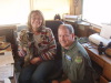
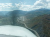
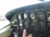
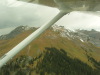
| North of Twin Lakes, CO, about 1 mile, streets cut into the trees. | Leadville, CO (LXV), servicing CAP C182. N652CP in the background, T182T/G1000/NavIII (KAP-140 autopilot). | Leadville, Lake County Airport (LXV), CO, hangar doors. Yes, 9927 MSL! | LXV, pilot warning: "Pilots please note surrounding mountains are 14,400'+, climb to altitude before crossing over". | LXV, FBO desk, Debbie, "Nipper" the cat, CAP pilot. | ||
| ||||||
|
|
|
|
|
||
| ||||||
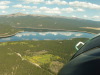
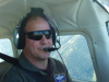
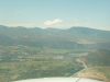
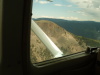
| LXV, departing northbound, Turquoise Lake on the left. Note calm water reflections of clouds. | LXV, Turquoise Lake. | Westbound toward Ruedi (say rude eye) Reservoir, NE of Aspen, CO. | CAP pilot happily flying in the mountains! | Looking SW toward mountains (W of Aspen), Castle Peak, right to Maroon Bells, then Capitol Peak. | ||
| ||||||
|
|
|
|
|
||
| ||||||
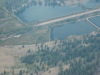
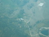
| C206, flying level at 10,850 MSL, westbound over Ruedi Reservoir. | C206, looking aft. | Ruedi Reservoir, north of Aspen. Consider... where would you land in an emergency? | Squawking 4704 into Aspen, CO. | C206 Panel, GPS setup for Aspen, CO (ASE). | ||
| ||||||
|
|
|
|
|
||
| ||||||
| Looking SW toward the mountains W of Aspen, CO. | Looking W to Mount Sopris, 12,953 (almost a 13er!), Carbondale, CO. | CAP pilot, still happy, flying on the side of the valley above Ruedi Reservoir. | Over Ruedi Reservoir, looking W to Basalt, CO. | East of Basalt, CO, looking S to Aspen Snowmass Ski area, evaluating the "Aspen Snowmass overhead approach into Aspen". | ||
| ||||||
|
|
|
|
|
||
| ||||||
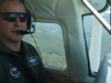
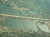
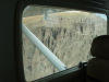
| Aspen Airport (ASE), CO, 2 mile final RWY 15, 1000 AGL. | Aspen Airport (ASE), CO, 1 mile final RWY 15, 800 AGL. | ASE, Aspen Base Operation (ABO at ASE), taxiing for departure RWY 33. | ASE, "We are the smallest thing on the ramp... we are a Cessna 206. | CAP pilot, still happy, taxiing for RWY 33 departure at ASE. | ||
| ||||||
|
|
|
|
|
||
| ||||||
| ASE, taxiing for RWY 33 departure. | ASE terminal building. | Aspen Airport (ASE), CO, "on the ground", 7,820 MSL. | ASE, looking SW toward Aspen town (on the left), Aspen Ajax Mountain (and ski area) just left of center. | ASE, looking NW toward ASE terminal and ramp, down taxiway parallel to RWY 33. | ||
| ||||||
|
|
|
|
|
||
| ||||||
| ASE, RWY 33, lining up for departure. | ASE, RWY 33, ready for takeoff. | ASE, RWY 33, rolling for takeoff. | ASE, RWY 33, accelerating for takeoff. | ASE, RWY 33, airborne, note ASE tower on the right. | ||
| ||||||
|
|
|
|
|
||
| ||||||
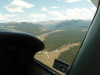
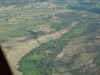
| ASE tower and north ramp, where the propeller airplanes tie down. Jet ramp is out of sight to the right. | ASE 33 departure, clearance to move left for jet departure behind us. | ASE 33 departure, 2 miles NW of ASE, looking left, W toward Basalt, El Jebel and Carbondale, enroute toward Glenwood Springs, CO. | ASE outbound, note, we are on the "right" (north) side of the valley. Inbound traffic will be level with that mountain at 8,900 MSL, 100' from the terrain. | Dirt airport ~3 miles E of Carbondale, CO. Looking SW. | ||
| ||||||
|
|
|
|
|
||
| ||||||
| Dirt airport ~3 miles E of Carbondale, CO. Carbondale is out of the picture to the right. | Looking W toward Carbondale, CO. Glenwood Springs, CO is to the right. | Glenwood Springs Airport (ASE), CO. ~4 miles S, looking NW. The airport is difficult to see just left of the two small peaks down low in the valley. | Crawford, CO, Boardwalk Restaurant | Crawford, CO, "Hangar with attached house", looking north. | ||
| ||||||
|
|
|
|
|
||
| ||||||
| Crawford, CO, Cessna-185 in the hangar. | Crawford, CO, "Hangar with attached house" airborne, looking north. | Crawford, CO, RWY25 departure, flying over the valley immediately W of the airport. | Crawford Airport (99V), CO, looking E toward RWY 7, looking back over the valley in the previous picture. | Crawford Airport (99V), CO, looking E toward RWY 7, with Crawford town right of the centerline and beyond the airport. | ||
| ||||||
|
|
|
|
|
||
| ||||||
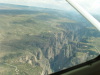
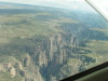
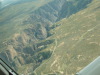
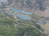
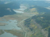
| Black Canyon of the Gunnison River, ~10 miles NW of 99V. | Black Canyon of the Gunnison River, note rim road on both sides of the canyon. | The "Painted Wall" of Black Canyon of the Gunnison River. 1 | The "Painted Wall" of Black Canyon of the Gunnison River. 2 | The "Painted Wall" of Black Canyon of the Gunnison River. 3 | ||
| ||||||
|
|
|
|

|
||
| ||||||
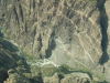
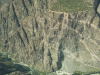
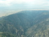
| The "Painted Wall" of Black Canyon of the Gunnison River. 4 | The "Painted Wall" of Black Canyon of the Gunnison River. 5, note rim road on the right. | The Black Canyon of the Gunnison River. 6, looking SE, note rim road parking area on the right. Note the shadows down to the canyon floor. | The Black Canyon of the Gunnison River. 7, looking S, note how deep and dark the base of the canyon is near the top of the picture. | The Black Canyon of the Gunnison River. 8, looking N, note it is called the "Black Canyon, because there are places on the canyon floor that never get direct sunlight. | ||
| ||||||
|
|
|
|
|
||
| ||||||
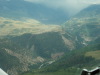
| The Black Canyon of the Gunnison River. 9, looking N. | Sawpit, CO, looking NW, ~8 miles N of Telluride, CO. | Sawpit, CO, looking E, it is at the "bottom of the T. | S of Sawpit, CO, looking SE. | CO high mountains, looking E, S of Sawpit, approaching Telluride, CO from the N. | ||
| ||||||
|
|
|
|
|
||
| ||||||
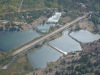
| Telluride Airport (TEX), CO, looking N to the ramp. RWY 9/27 is in the foreground. | TEX approach end of RWY 27. | Telluride Ski area, looking E toward town, turning left base TEX RWY 27. | Telluride Ski area, looking E toward town, note base area is well above town. Telluride town is off the left ridge, on the valley floor. | Telluride Airport (TEX), CO, looking W to the ramp, ~1 mile final RWY 27. | ||
| ||||||
|
|
|
|
|
||
| ||||||
| Telluride Airport (TEX), CO, jets here, too. | Telluride Airport (TEX), CO, departing RWY 27, airborne. The trucks are moving dirt to level and extend the airport. | Telluride Airport (TEX), CO, departing RWY 27, looking E, see canyon wall to upper access roads. | Telluride Airport (TEX), CO, departing RWY 27, large house overlooking the airport. | Telluride Airport (TEX), CO, departing RWY 27, looking E toward large house above and NE of the airport. | ||
| ||||||
|
|
|
|
|
||
| ||||||
| Telluride Airport (TEX), CO, departing RWY 27, looking E toward large houses above and NE of the airport. | Telluride Airport (TEX), CO, departing RWY 27, still climbing, mountain on the right. | Telluride Airport (TEX), CO, departing RWY 27, still climbing, looking E, below the nearby mountain top. | North of Telluride, over Sawpit, looking WSW. | North of Telluride, looking SW. Telluride is over the near ridge and left. | ||
| ||||||
|
|
|
|
|
||
| ||||||
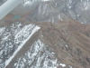
| S of Ouray,CO, looking S, enroute to Cinnamon Pass. | Crossing S of Cinnamon Pass, looking at ~13,000 knoll S. | Crossing SE of Cinnamon Pass, looking S at the opening valley. | Clouds above the mountain tops, over 13,000 MSL. | There is snow in them thar clouds! | ||
| ||||||
|
|
|
|
|
||
| ||||||
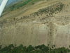
| E of the weather, looking S, near Lake City, CO. | Clouds are clearing to SE. | Clouds above the 13,000 mountain tops, SW of Lake City, CO. | Looking SE toward Slumgullion and Spring Creak Passes toward Creede, CO, from SW of Lake City, CO. | Bare rock above timberline in CO. Note recent snow on Sep 17, 2008. | ||
| ||||||
|
|
|
|
|
||
| ||||||
| Snow above timberline, SW of Lake City, CO, looking SE, Sep 17, 2008. | More snow above timberline, SW of Lake City, CO, looking SE, Sep 17, 2008. | SW of Lake City, CO, looking SSW toward Castle Lakes Airport (CD32), CO. | SW of Lake City, CO, looking SSW down the valley toward Castle Lakes Airport, which is around the corner to the left. | Flying at tree-line, after light snow, looking S, SW of Lake City, CO. | ||
| ||||||
|
|

|

|

|
||
| ||||||
| Flying at tree-line, after light snow, looking SE, SW of Lake City, CO. | Ridge above tree-line, SW of Lake City, CO, looking SE toward Spring Creek Pass and Creede, CO. | ? Looking S neat Lake City. Paved road with settling pond. | Peak SE of Lake City. | Peak SE of Lake City. 2 | ||
| ||||||

|

|

|

|

|
||
| ||||||
| Peak SE of Lake City. | Peak SE of Lake City. | Peak SE of Lake City. | Peak SE of Lake City. | Peak SE of Lake City. | ||
| ||||||

|

|
|
|
|
||
| ||||||
| Peak SE of Lake City. | Peak SE of Lake City. | Peak SE of Lake City. | Peaks SE of Lake City. | Peaks SE of Lake City. | ||
| ||||||
|
|
|
|
|
||
| ||||||
| Peaks SE of Lake City. | Peaks SE of Lake City. | Peak SE of Lake City. | Peak SE of Lake City. | 13,400 MSL, descending 400 FPM. | ||
| ||||||
|
|
|
|
|
||
| ||||||
| Peak SE of Lake City. | Peak SE of Lake City. | Castle Lakes Airport (CD32), CO, looking E toward RWY 4. #1. | Castle Lakes Airport (CD32), CO, looking E toward RWY 4. #2. | Aspen trees changing color above Castle Lakes Airport on Sep 17, 2008. | ||
| ||||||
|
|
|
|
|
||
| ||||||
| Castle Lakes Airport (CD32), CO, looking E toward RWY 4. #3. Note diagonal access road right of mid-field, and the county road E to S. | Castle Lakes Airport (CD32), CO, looking E toward RWY 4. #4. Note airplane tiedown area to the right of the diagonal access road on the far side of RWY 4. | Castle Lakes Airport, looking E. #5. | Castle Lakes Airport, looking E toward the approach end of RWY 22.. #6. | Castle Lakes Airport, looking ESE. RWY 22 on left, RWY 4 on right. #7. | ||
| ||||||
|
|
|

|

|
||
| ||||||
| Castle Lakes Airport, looking at RWY 22. Note white distance markers. #8. | Castle Lakes Airport, looking ESE at RWY 22 on left, RWY 4 on the right. #9. | Castle Lakes Airport, note calm wind indication on upper pond. Wind is < 3 knots from 060 degrees. #10. | Castle Lakes Airport, looking SW from RWY 22 to RWY 4. Note bridge across from the diagonal access road beyond midfield. #11. | Castle Lakes Airport, looking at RWY 22. Note white distance markers. #12. | ||
| ||||||
|
|
|
|
|
||
| ||||||
| Castle Lakes Airport, looking SW, RWY 4 on the left, RWY 22 on the right. #13. | Castle Lakes Airport, looking SW, RWY 4 on the left. Note campers on bottom right of frame. #14. | Castle Lakes Airport, looking W, RWY 4 on the left. Note diagonal access road near midfield, with bridge on the other side of the runway. #15. | Castle Lakes Airport, looking N, RWY 4 on the left. Note campers on right, with the parking lot of the B&B left of the campers. #16. | Castle Lakes Airport, looking N, RWY 4 on the left. Note campers on both sides of the runway, the bridge and the white markers on the runway. #16. | ||
| ||||||

|

|
|
|
|
||
| ||||||
| Castle Lakes Airport, looking NE from RWY 4 to RWY 22. Note bridge across from the diagonal access road beyond midfield. #17. | Castle Lakes Airport, looking NE to RWY 4. Note tiedown area near diagonal access road. #18. | Castle Lakes Airport, looking NE, RWY 22 on the left, RWY 4 on the right. Note campers, access road and county road. #19. | Castle Lakes Airport, looking NE, RWY 22 on the left, RWY 4 on the right. Note campers, access road and county road. #20. | Destination mountain resort, lodge in center, covered arena on right. Looking S, E of Castle Lakes Airport, SW of Lake City, CO. #1. | ||
| ||||||
|
|

|

|

|
||
| ||||||
| Destination mountain resort, lodge in center, covered arena on right. Looking S, E of Castle Lakes Airport, SW of Lake City, CO. #2. | Destination mountain resort, looking down on covered arena. Looking S, E of Castle Lakes Airport, SW of Lake City, CO. #3. | Lake Shore, CO, looking N, 4 miles toward Lake City. Slumgullion Pass is on the right. #1. | Lake Shore, CO, looking N, 4 miles S of Lake City. Toward Slumgullion Pass on the right. #2. | Over Spring Creek Pass, CO, looking W toward small lakes. | ||
| ||||||
|
|

|
|
|
||
| ||||||
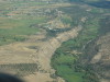
| 1 valley further S of Spring Creek Pass, CO, looking W. Note runway near center of the picture. | Peak 12,708 MSL, above Santa Maria Lake, W of Creede Airport (C24), CO. #1. | Bare rock face, peak 12,708 MSL, above Santa Maria Lake, W of Creede Airport (C24), CO. #2. | Bare rock face, peak 12,708 MSL, above tree-line, Santa Maria Lake, W of Creede Airport (C24), CO. #3. | Peak 12,708 MSL, looking SE, Creede Airport (C24), CO, is around the corner to the left. | ||
| ||||||
|
|
|
|
|
||
| ||||||
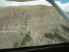
| Peak 12,708 MSL, looking E, Creede Airport (C24), CO, is around the corner to the left. | W of peak 12,708 MSL, looking SE, Creede Airport (C24), CO, is around the corner to the left. | W of peak 12,708 MSL, looking SSE, Creede Airport (C24), CO, is around the corner to the left. | W of peak 12,708 MSL, looking E, Creede Airport (C24), CO, is over the ridge on the valley floor. | The aspen trees are changing color S of Creede, CO, 09/17/08. 1 | ||
| ||||||
|
|
|
|

|
||
| ||||||
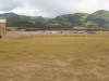
| The aspen trees are changing color S of Creede, CO, 09/17/08. 2 | Mineral County Airport (C24), Creede, CO, turning left base RWY 25. | Mineral County Airport (C24), left base RWY 25. Note ramp on the right of the runway. | Mineral County Airport (C24), turning final base RWY 25. The campground is across the road east of the airport. | Mineral County Airport (C24), classic facilities. 1 | ||
| ||||||

|

|
|
|
|
||
| ||||||
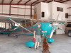
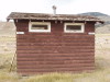
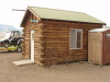
| Mineral County Airport (C24), classic facilities. 2 | Mineral County Airport (C24), classic facilities. 3 | Mineral County Airport (C24), classic facilities, Men left, Women right. 4 | Mineral County Airport (C24), looking S from facilities to the ramp. C206 on the ramp. | Mineral County Airport (C24), airport building. 1 | ||
| ||||||
|
|
|
|
|
||
| ||||||
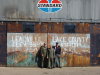
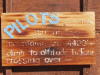
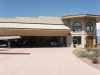
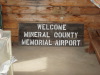
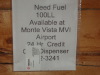
| Mineral County Airport (C24), airport building, welcome sign. | Mineral County Airport (C24), airport building, how to get fuel... elsewhere. | Creede, CO, shuttle climb, looking S. Aspen are changing color. 1 | Creede, CO, shuttle climb, looking S. Aspen are changing color. 2 | Creede, CO, Wheeler Geologic Area, intrusive rock formation. 1 | ||
| ||||||
|
|
|
|
|
||
| ||||||
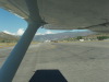
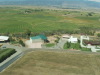
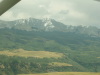
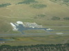
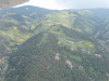
| Half Moon Pass looking SE toward Wagon Wheel, CO, NE of Creede, CO. | Quarter-Circle Circle Ranch Airport (QCC), ~50 SE of Gunnison, CO. Runway 2/21, condition check parallel to RWY 2. 09/16-18, 2008 | Looking W from go-around at Quarter-Circle Circle Ranch Airport (QCC). 1 09/16-18, 2008 | Looking W from go-around at Quarter-Circle Circle Ranch Airport (QCC). 2 09/16-18, 2008 | Aspen changing color near Marshall Pass, CO, ~4 SE of Monarch Pass (we do not fly Monarch Pass). 1 | ||
| ||||
|
|
|
||
| ||||
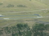
| Aspen changing color near Marshall Pass, CO, ~4 SE of Monarch Pass (we do not fly Monarch Pass). 2 | Aspen changing color near Marshall Pass, CO, ~4 SE of Monarch Pass (we do not fly Monarch Pass). 3 | Harriett Alexander Airport (ANK), Salida, CO, turning left base RWY 24, after a great day of mountain flight training. 09/17/08. | ||