 | ||||||
|
|
|
|
|
||
| ||||||
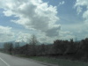
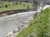
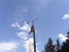
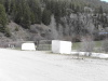
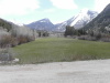
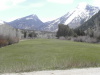
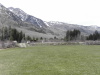
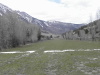
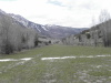
| Driving from Glenwood Springs, CO. Looking S to Mount Sopris. Aspen is to the left, Marble to the right. | Marble River, N of Redstone. The rocks enclose the hot spring. | Wind indicator at Marble Airport, Colorado. | Marble blocks guard the gate at the W end of the airport. | Looking E from the road at the W end of the airport. 1 | ||
| ||||||
|
|
|
|
|
||
| ||||||
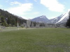
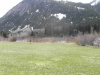
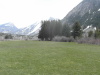
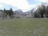
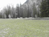
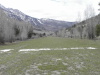
| Looking E from the road at the W end of the airport. 2 | Looking E from the road at the W end of the airport. 3 Note windsock above white marble. | Looking W on the road at the W end of the airport. | Looking W from the W end of the airport, McClure Pass is to the right. | Looking SE to pond and Marble River. | ||
| ||||||
|
|
|
|
|
||
| ||||||
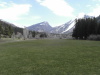
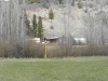
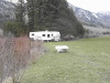
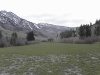
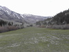
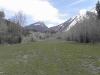
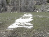
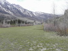
| W end of airport. Owner's trailers in the trees on R. 1 | W end of airport. Owner's trailers in the trees on R. 2 | Telephone box hazard marked with colored stick on N side of runway. | Marble bench, looking SW. | Looking W from 3/4 W to E. Note surface with rocks. 1 | ||
| ||||||
|
|
|
|
|
||
| ||||||
| Looking W from 3/4 W to E. Note surface with rocks. 2 | Looking E from 3/4 W to E. Note surface with rocks. 3 | 3/4 from W to E, looking ESE. Marble slabs stacked to form a table. | E end of runway. Note white stripe across the runway, depicting the displaced threshold. | Looking N across displaced threshold at the east end of the runway. The road is visible. | ||
| |||||
|
|
|
|
||
| |||||
| Looking W across the displaced threshold. 1 | Looking W across the displaced threshold. 2 | Looking W across the displaced threshold. 3 | N edge of runway, looking W at telephone box hazard marked with colored stick. | ||